
Country United States Organized as township 1858 Zip code 15052 Population 1,810 (2013) | State Pennsylvania Settled 1836 Incorporated as borough 1960 Local time Sunday 3:02 PM | |
 | ||
Weather -2°C, Wind NW at 14 km/h, 48% Humidity Area 28.49 km² (26.16 km² Land / 207 ha Water) | ||
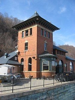
Industry is a borough in Beaver County, Pennsylvania, along the Ohio River. As of the 2010 census, the borough population was 1,835.
Contents
Map of Industry, PA, USA
History
The borough was organized as the Township of Industry in 1856 from an electoral district named Industry that comprised portions of Ohio Township and Brighton Township. The township incorporated as a borough in 1960.
The village of Industry was a settlement in the township laid out in 1836 by William McCallister, though a post office had been established in 1833. The name was selected to promote the town's industry.
Geography
Industry is located at 40°39′22″N 80°24′34″W (40.656017, -80.409538). It is bordered to the west by Midland, to the northwest by Ohioville, to the north by Brighton Township, and to the northeast by Vanport Township. The southern boundary of Industry is the Ohio River. To the southeast across the river is Potter Township, to the south is a small portion of Raccoon Township, and to the southwest is Shippingport.
Pennsylvania Route 68 (Midland Beaver Road) is the main road through the borough, leading west into Midland and east to Beaver.
According to the United States Census Bureau, Industry has a total area of 11.0 square miles (28.4 km2), of which 10.1 square miles (26.2 km2) is land and 0.85 square miles (2.2 km2), or 7.68%, is water.
The community of Merrill was located in the southeastern part of the borough, along the Ohio River. No one has lived in Merrill since the 1960s at the latest (probably much earlier).
Demographics
As of the census of 2000, there are 1,921 people, 772 households, and 581 families residing in the borough. The population density is 195.2 people per square mile (75.4/km²). There are 816 housing units at an average density of 82.9 per square mile (32.0/km²). The racial makeup of the borough is 96.88% White, 1.93% African American, 0.05% Native American, 0.16% Asian, 0.57% from other races, and 0.42% from two or more races. 1.41% of the population are Hispanic or Latino of any race.
There are 772 households, out of which 28.9% have children under the age of 18 living with them, 60.0% are married couples living together, 9.5% have a female householder with no husband present, and 24.7% are non-families. 22.0% of all households are made up of individuals, and 11.0% have someone living alone who is 65 years of age or older. The average household size is 2.47 and the average family size is 2.85.
In the borough the population is spread out, with 21.3% under the age of 18, 6.9% from 18 to 24, 26.1% from 25 to 44, 27.7% from 45 to 64, and 18.0% who are 65 years of age or older. The median age is 43 years. For every 100 females there are 98.7 males. For every 100 females age 18 and over, there are 94.2 males.
The median income for a household in the borough is $38,125, and the median income for a family is $43,571. Males have a median income of $34,667 versus $22,731 for females. The per capita income for the borough is $18,337. 8.1% of the population and 6.9% of families are below the poverty line. Out of the total population, 14.0% of those under the age of 18 and none of those 65 and older are living below the poverty line.