
Length 51.02 km | ||
 | ||
Counties | ||
State Road 116 in the U.S. state of Indiana is an east–west state highway that runs in a southeast-to-northwest direction.
Contents
Map of IN-116, Indiana, USA
Route description
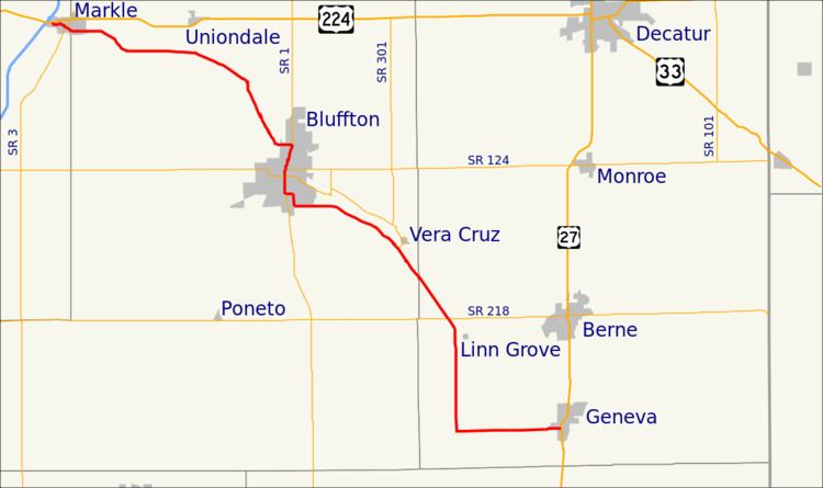
State Road 116 starts in the town of Markle at U.S. Route 224 and travels southeast through the small town of Murray to Bluffton and past Ouabache State Park. It continues southeast, past the small towns of Vera Cruz and Linn Grove, to Geneva where it terminates at U.S. Route 27.
History
SR 116 was originally designated between late 1930 ans early 1932. The highway ran between SR 16 in Markle and SR 3, now SR 1, north of Bluffton. Between 1935 and 1936 the original segment of SR 116 was under construction to become to come paved. The road was extended east to Wells County State Forest, now Ouabache State Park, between 1936 and 1937. The Indiana State Highway Commission moved the road south between Bluffton and Wells County State Forest between 1939 and 1941. At this time an extension of SR 116 to the southeast occurred moving the eastern end to US 27 in Geneva. The road was extended east to the Ohio state line east of New Corydon, between 1942 and 1945. Between 1966 and 1967 the entire road east of Bluffton was paved. A short reroute on the southeast part of Bluffton to its modern routing occurred between 1993 and 1995. SR 116 east of US 27 was removed from the state road system between 1999 and 2000.