
NRHP Reference # 70000533 Added to NRHP 6 October 1970 | Year built 1870 | |
 | ||
Location | ||
Indian meridian warriors 1994 3rd grade oklahoma
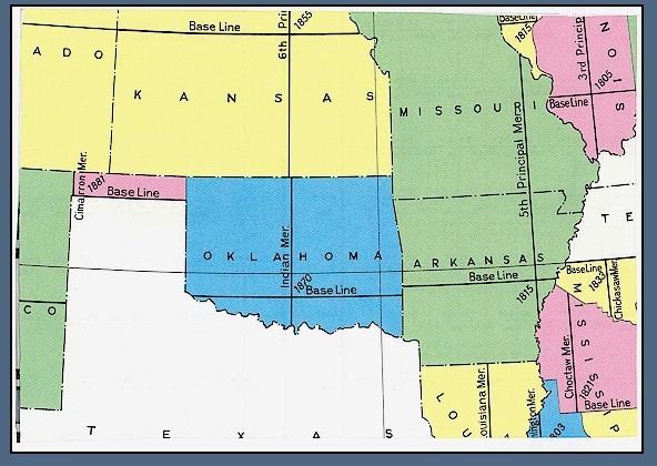
The Indian meridian, in longitude 97° 14′ 30″ west from Greenwich, extends from Red River to the south boundary of Kansas, and, with the base line in latitude 34° 30′ north, governs the surveys in Oklahoma east of 100° west longitude from Greenwich (all of Oklahoma except the Oklahoma panhandle).
Contents
- Indian meridian warriors 1994 3rd grade oklahoma
- Shl brain break challenge k 2 indian meridian
- References
This line was chosen arbitrarily as part of the land survey of 1870 conducted by E. N. Darling and Thomas H. Barrett, at an arbitrary point about one mile south of Fort Arbuckle (about six miles west of present Davis, Oklahoma). From this initial point, the north-south line was designated as the Indian meridian and the East–West line was designated as the Indian baseline.
The Indian Meridian initial point is listed in the National Register of Historic Places with ID #70000533.