
 | ||
Inca rule in Chile was brief, it lasted from the 1470s to the 1530s when the Inca Empire collapsed. The main settlements of the Inca Empire in Chile lay along the Aconcagua, Mapocho and Maipo rivers. Quillota in Aconcagua Valley was likely their foremost settlement. The bulk of the people conquered by the Incas in Central Chile were Diaguitas and part of the Promaucae (also called Picunches).
Contents
Inca expansion
The exact date of the conquest of Central Chile by the Inca Empire is not known. It is generally accepted that Central Chile was conquered during the reign of Topa Inca Yupanqui and most early Spanish chronicles point out that conquest occurred in the 1470s. Beginning with 19th century historians Diego Barros Arana and José Toribio Medina various scholars have pointed out that the incorporation of Central Chile to the Inca Empire was a gradual process. Nevertheless, it is generally accepted that incorporation into the empire was through warfare which caused a severe depopulation in the Transverse Valleys of Norte Chico, the Diaguita homeland.
One theory claims Central Chile was conquered by the Inca Empire from the east after Inca troops crossed the Andes at Valle Hermoso (32º22' S) and Uspallata Pass (32º50' S). This attack from the east would have been done in order to avoid the more direct but inhospitable routes crossing the Atacama Desert. José Toribio Medina claimed in 1882 that the Incas entered Central Chile from both north and east.
Troops of the Inca Empire are reported to have reached Maule River and had a battle with Mapuches from Maule River and Itata River there.
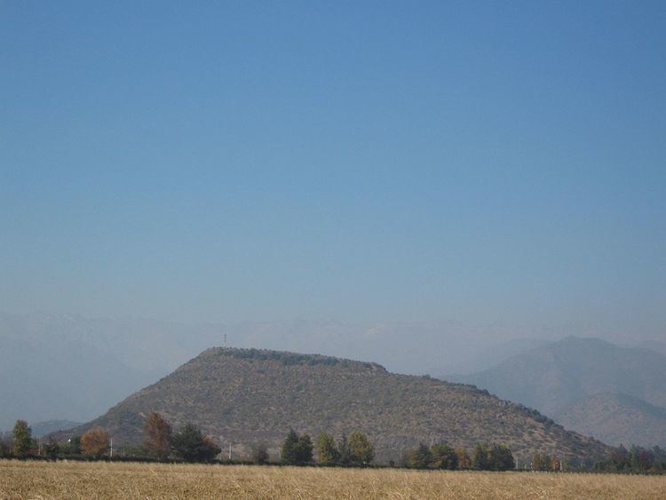
Battle of the Maule
After securing the regions of northern Chile, Copiapó, Coquimbo, Aconcagua and the Maipo Valley around what is now Santiago, the Inca general Sinchiruca sent 20,000 men down to the valley of the Maule River. The Picunche people, who inhabited this last region south of Maipo Valley up to the Itata River, refused to submit to the rule of the Inca and called on their allies south of the Maule; the Antalli, Pincu, and Cauqui to join in opposing these invaders. This defiance gave them their distinctive name of Purumaucas from the quechua puruma auca meaning those not under the rule of the Inca. The Spanish later corrupted the name into Promaucaes.
The Incas crossed the Maule River, and keeping their old custom, they sent messengers to require these Purumaucas to submit to the rule of the Inca or resort to arms. The Purumaucas had determined to die before losing their freedom, and responded that the victors would be masters of the defeated and that the Incas would quickly see how the Purumaucas obeyed. Three or four days after this answer, the Purumaucas and their allies arrived and camped in front of the Incas' camp with 18,000 - 20,000 warriors. The Incas tried diplomacy, offering peace and friendship, claiming they were not going to take their land and property but to give them a way to live as men. The Purumaucas responded saying that they came not to waste time in vain words and reasoning, but to fight until they won or died. The Incas promised battle the next day.
The following day both armies left their camps and fought all day without either gaining an advantage, and both suffering many wounded and dead. At night they both retired to their positions. On the second and third day they fought with the same results. At the end of the third day of battle both factions saw that they had lost more than half their number in dead, and the living were almost all wounded. On the fourth day, neither side left their own camp, which had been fortified, as they hoped to defend them if their opponents attacked. The fifth and sixth days were passed in the same manner but by the seventh the Purumaucas and their allies retired and returned home claiming victory.
Southern border of the Empire
The southern border of the Inca Empire is believed by most modern scholars to be situated between Santiago and Maipo River or somewhere between Santiago and Maule River. Spanish chroniclers Miguel de Olavarría and Diego de Rosales claimed the Inca frontier lay much more to the south at the Bío Bío River. Regardless of these differing claims on the frontier of the Inca Empire, Inca troops appear to have never crossed Bío Bío River. As it appear to be the case in the other borders of the Inca Empire the southern border was composed of multiple zones. First an inner fully incorporated zone with mitimaes protected by a line of pukaras (fortresses) and then an outer zone with Inca pukaras scattered among allied tribes. This outer zone would have been located between Maipo and Maule rivers.
Incan yanakuna are believed by archaeologists Tom Dillehay and Américo Gordon to have extracted gold south of the Incan frontier in free Mapuche territory. Following this thought, the main motive for Incan expansion into Mapuche territory would have been to access gold mines. Same archaeologists also claim all early Mapuche pottery at Valdivia is of Inca design. Inca influence is possibly evidenced as far south as Osorno Province (latitude 40–41° S) in the form of Quechua and Quechua–Aymara toponyms. Alternatively these toponyms originated in colonial times from the population of the Valdivian Fort System that served as a penal colony linked to the Peruvian por of El Callao.
Diaguita society
The Incas influenced the Diaguitas who adopted pottery designs from Cuzco and Inca techniques in agriculture and metalworking.
Mapuche society
Through their contact with Incan invaders Mapuches would have for the first time met people with state organization. Their contact with the Incas gave them a collective awareness distinguishing between them and the invaders and uniting them into loose geo-political units despite their lack of state organization.
Road network
The Incas used an extensive road network in Chile as well as in the rest of the empire. North of Copiapó Valley the main difficulty for the Inca road system was the lack of water, south of Copiapó Valley the main difficulty was the uneven relief with many mountain ranges and valleys. To deal with these problems the Incas adopted two strategies and built two north–south roads from Copiapó Valley to Maipo Valley each of these according a strategy. One road, the Longitudinal Andean Inca Road (Spanish: Camino Inca Longidunal Andino), went high in the Andes through the valley heads where the valleys were less deep. The other one followed coastal plains.
The Longitudinal Andean Inca Road runs from the latitude of Huasco Valley north–south mainly along a series of geological faults (including Valeriano Fault). From a latitude of 28° S to 38° S it this road runs above 4,000 m.a.s.l. close to the Argentine–Chilean border. Around the latitude of Choapa Valley the road descends to around 2,000 m.a.s.l. The Longitudinal Andean Inca Road is connected to a parallel Inca road in Argentina through several road that crosses the Andean water divide. This road allowed to access several mining districts and had plenty of water. On the other hand, its climate was of a large diurnal temperature range and it was not accessible in winter due to snowfall.
The coastal road allowed for a more straight north–south movement. It also enjoyed a less harsh climate than the Longitudinal Andean Inca Road and was accessible the all year round. This road goes mostly ca. 30 km east of the Pacific Ocean but it also access the sea at some places. It was the route used by Diego de Almagro in 1536.