
Airport type Public Location Imphal, Manipur, India Code IMF Phone 0385 245 5069 | Serves Imphal, Manipur Elevation AMSL 2,540 ft / 774 m Elevation 2,542 m Yearly aircraft movements 6,078 | |
 | ||
Owner Public Government of Manipur Operator Airports Authority of India Address NH 150, Imphal, Manipur 795140 Similar Central Public Works De, Post Office, Manipur University, The Classic Hotel, Hotel Bheigo | ||
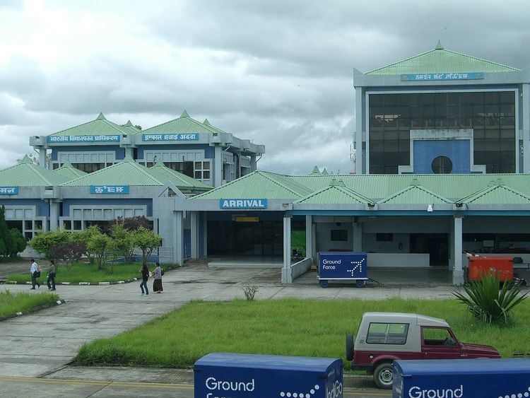
Bir Tikendrajit International Airport (IATA: IMF, ICAO: VEIM) is the second international airport built in the Northeastern region of India, after Guwahati, and the second largest busiest international airport in the north east region after Guwahati. It's named after king Tikendrajit. Located 8 km south of Imphal, the capital of Manipur, Imphal International Airport connects northeastern India with the country's major cities such as Bengaluru, Delhi, Kolkata, and with the Myanmar city of Mandalay. AirAsia India, Air India, IndiGo, Jet Airways, Air India Regional, JetKonnect, Golden Myanmar Airlines, and North East Shuttle Airlines offer connection services from the airport to major cities and regional airports such as Agartala, Silchar, Aizawl, and Jorhat. Connecting flights to Rangoon, Mandalay, Naypyidaw, Myanmar, Bangkok, Chiang Mai and Thailand are in development.
Contents
Imphal International Airport is under the administrative control of Airports Authority of India.
Technical Information
Situated at 2545 feet (774.80m) above sea level, the airport covers 1275 acres (515.97 hectares). The runway measures 2,746 metres in length. Imphal International Airport is equipped with many modern passenger facilities including the facilities for night operation. The airport is equipped with the Precision Approach Path Indicator (PAPI) guidance system, which provides visual aid on both sides of the runway to assist pilots with maintaining the correct path of approach. A CAT-I ILS at runway 04 is also available to assist with aircraft landing.
There are currently two departure gates and two arrival gates at the airport. International & Domestic Terminal-1 has 10 check-in counters. The Departure section can service up to 60000 travelers, while the arrival section services up to 35000 travelers. The airport is suitable for 'C' type (Airbus 320 or 321) aircraft operations in all weather conditions. It is also suitable for aircraft such as the ATR42, A320, A321, A330, and Boeing 737 NG, 767 series.And frequently many military transport aircraft like BOEING C-17 and IL-76 of the Indian Air Force heavy lifter operates from this Airport.
History
Imphal RAF station, as it was formerly known, is located 45 km away from the Imphal International Airport at Kakching area which now serves as a military base of the Indian Army and was a major allied forces supply airfield during World War II. The presence of this airbase allowed allied forces to fly in men, equipment, and supplies. This provided a lifeline to the town, which was otherwise cut off by land. Allied aircraft also parachuted ammunition, rations, and drinking water to the encircled Indian combat units during the Battle of Imphal, in which Japanese forces attempted to take control of Imphal. The Japanese forces suffered heavy losses and were eventually driven back to Burma.
Connectivity with the City from Imphal Airport
Imphal International Airport is well connected by public and private bus services and by auto rickshaws. These transport services connect the airport to the city center via the Imphal Churachandpur State Highway (also known as Tiddim Road).
Accidents
On 16 August 1991, Indian Airlines Flight 257 crashed while descending into Imphal airport. All 69 passengers on board, including the crew members, were killed.