
Country Germany Admin. region Freiburg Elevation 662 m (2,172 ft) Area 74.03 km² Local time Saturday 9:05 AM Dialling code 07462 | State Baden-Württemberg District Tuttlingen Time zone CET/CEST (UTC+1/+2) Postal code 78194 Population 6,247 (31 Dec 2015) Administrative region Freiburg | |
 | ||
Weather 5°C, Wind E at 8 km/h, 60% Humidity | ||
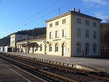
Immendingen is a municipality in the district of Tuttlingen in Baden-Württemberg in Germany.
Contents
- Map of Immendingen Germany
- Geography
- History
- Culture and sights
- Buildings
- Natural Monuments
- Regular events
- References
Map of Immendingen, Germany
Geography
Immendingen is located on the Upper Danube. On the municipal area are parts of the Danube Sinkhole.
With the mountain Höwenegg in Immendingen begins the extinct volcanic landscape of Hegau. Archaeological excavations at the Höwenegg recover saber-toothed tigers, antelopes and one of the few well preserved ancestral horses.
The municipality borders Talheim to the north, Tuttlingen to the east, Emmingen-Liptingen to the southeast, Engen to the south, and Geisingen and Bad Durrheim to the west.
The whole municipality with the previously independent municipalities Hattingen, Hintschingen, Ippingen, Mauenheim and Zimmern include 22 villages, hamlets, farms and houses.
Coat of arms of several incorporated municipalities
History
Immendingen was built at the crossroads of ancient trade routes. As the name suggests, it was a settlement of the alemannic period. The name goes back to an Alemannic patriarch, who settled with his family in the valley of the Danube.
The first documentary evidence dates back to 1101.
In the Carolingian period, the village belonged to the Aitrach to Hegau and was assigned to the Baar in the 12th century. Originally owned by the Counts of Zollern the area eventually became part of the Zähringers. In 1250 it was taken over by the Count of Fürstenberg. Many centuries are dominated by local lords living in the community. Significant gender of the local lords were the lords of Schreckenstein (on the „Upper Castle“) and the lords of Reischach (on the „Lower Castle“).
In the course of municipal reform in Baden-Württemberg, the hitherto separate municipality Zimmern was incorporated on 1 January 1971. On 1 December 1971, the incorporation of Mauenheim was. Hattingen, Hintschingen and Ippingen were incorporated on December 1, 1974.
In December 1958 the barracks „Oberfeldwebel-Schreiber-Kaserne“ was built. According to the current stationing concept of the Bundeswehr the barracks will be closed in the third quarter of 2016. The 3rd French hussar regiment of the Franco-German Brigade was based in barracks from 1996 to 2011.
Culture and sights
The municipality is member of the tourism association „Donaubergland“.