
Basin size 393 km² Basin area 393 km² | Length 33 km | |
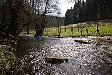 | ||
The Ilme is a left-bank, western tributary of the River Leine in Lower Saxony, Germany. It is 32.6 km long.
Contents
Map of Ilme, Germany
GeographyEdit
The river begins at the Neuer Teich pond in the centre of the Solling hills at a height of 340 m above sea level (NN) and flows initially northwards to Dassel, then in an easterly direction through Markoldendorf to Einbeck, after which it discharges into the Leine near Volksen at a height of 105 m.
References
Ilme Wikipedia(Text) CC BY-SA