
Existed: 1924 – present North end: US 34 in LaMoille Constructed 1924 | Length 89.29 km | |
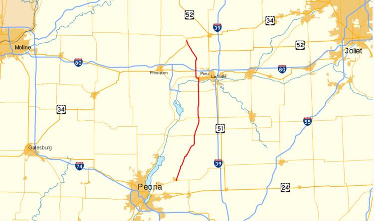 | ||
Illinois Route 89 is a rural, north–south state highway in central Illinois. It runs from U.S. Route 34 in La Moille to Illinois Route 116 in Metamora. Routes 26 and 89 are the main north–south roads between Interstate 39/U.S. Route 51 and Illinois Route 29. This is a distance of 55.48 miles (89.29 km)
Contents
Map of IL-89, Illinois, USA
Route description
Starting at La Moille, Route 89 travels south and passes through the small towns of Arlington, Cherry, and Ladd, where it crosses Interstate 80. After passing Spring Valley and crossing the Illinois River, Illinois 89 crosses Illinois Route 71 near Granville, then passes through McNabb. After crossing Illinois Route 18 in Magnolia and Illinois Route 17 at Varna, it then passes through LaRose and Washburn as only state highway in those two towns. It becomes North Niles Street in Metamora and ends at Mount Vernon Street, Illinois Route 116.
History
SBI Route 89 originally ran from Dixon to Metamora along Illinois Route 26 and Illinois 71. It was truncated north at Granville in 1938 and rerouted to La Moille.