
Existed: 1950 – present Length 21.84 km | Constructed 1950 | |
 | ||
Major cities | ||
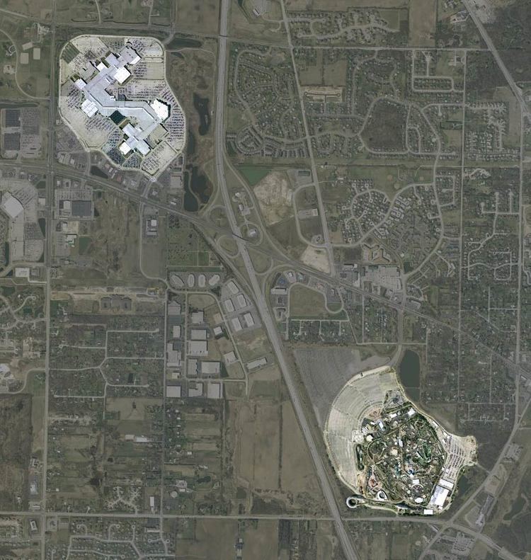
Illinois Route 132 is an arterial state road that connects Illinois Route 59 at the village line between Fox Lake Hills and Lake Villa, with Illinois Route 131 in Waukegan. It is known as Grand Avenue for its entire length, and Grand Avenue extends west beyond Lindenhurst to near U.S. Route 12, 12 miles (19 km) west. Though Illinois 132 is one of the busiest state highways in Illinois, it is only 13.57 miles (21.84 km) long (21.83 km).
Contents
Map of IL-132, Illinois, USA
Route description
Illinois 132 serves the town of Gurnee. Grand Avenue is the main road to both the Gurnee Mills Shopping Center and Six Flags Great America. At this point Illinois 132 is a divided, six lane road—its length wavers between 2 and 6 lanes around Gurnee.
Because Route 132 is a well-traveled road in suburban Chicago, it is also a major suburban Chicago shopping and industry corridor, especially on the Grand Avenue section of the route. A variety of car dealers, retail stores, full-service restaurants, mid-range hotels, etc. are located on this roadway.
History
SBI Route 132 was initially what is now Illinois Route 121 from Decatur to Mattoon in central Illinois; in 1937, Illinois 121 replaced Illinois 131 and Illinois 132. In 1950 it was reassigned to the whole stretch of Grand Avenue; in 1967 it was dropped east of Illinois 131 and west of Illinois Route 59.
Major intersections
The entire route is in Lake County.