
Archipelago Baleric Islands Highest elevation 15 m (49 ft) Elevation 7 m Max length 1.2 km | Width 0.3 km (0.19 mi) Population uninhabited Area 34 ha | |
 | ||
What 2 do in menorca ep 3 far illa de l aire s3 girls edition
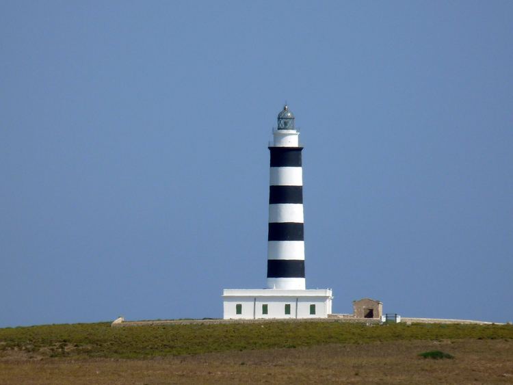
Illa de l'Aire (also Isla del Aire in Spanish) in an islet on the southeast coast of Minorca, in the Baleric Islands, close to Punta Prima, Sant Lluís. It is privately administrated by the municipality of Sant Lluís.
Contents
- What 2 do in menorca ep 3 far illa de l aire s3 girls edition
- Map of Illa de lAire Balearic Islands Spain
- References
Map of Illa de l'Aire, Balearic Islands, Spain
The island covers 34 hectares and has a circumference of 3.3 km. Its highest point was 15 m above sea level until the construction of the Illa de l'Aire lighthouse. The island is defined as the most southernly area of the Balearic Sea, a small body of water that is generally accepted a region of the Mediterranean Sea.
The island has an endemic lizard subspecies, Podarcis lilfordi lilfordi (Günther, 1874). On Minorca, it is better known as the sargantana negra (black lizard), though the lizards are able to change their skin colour to blend in with their surroundings. Very few people are actually allowed to land on the island as this would affect the lizards' unadvanced immune systems. Indeed, the Illa de l'Aire is sometimes known as "Lizard Island", and forms an iconic backdrop for the resort of Punta Prima and the municipality of Sant Lluís.
The island has a population of 300 rabbits, an introduced animal, which have recently increased in numbers after developing an immunity to myxomatosis.