
Area 3 km² | Population 200 | |
 | ||
Similar Obo Natural Park, Pico de São Tomé, Pico Cão Grande, São Sebastião Museum, Praia Jale | ||
The paradise of sao tom and principe ilhe u das rolas
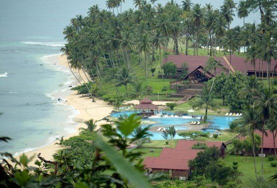
Ilhéu das Rolas is an islet in São Tomé and Príncipe, in Africa. The island lies on the equator, off the southern tip of São Tomé Island. It is in the Caué District of São Tomé Province. The island is home to a small resort, the Pestana Equador.
Contents
- The paradise of sao tom and principe ilhe u das rolas
- Map of Rolas Island SC3A3o TomC3A9 and PrC3ADncipe
- Confirmation of equatorial position
- References
Map of Rolas Island, S%C3%A3o Tom%C3%A9 and Pr%C3%ADncipe
The main and dominant economic activity is tourism, related mainly to the resort. A permanent population of approximately 200 people works in the island's tourism sector.
The island can only be accessed by boat departing from São Tomé Island.
Much of the southern part is in the Southern Hemisphere, its total area of that portion covering over 80% of the island covers 5 km2 of the islet and only less than 1% of the nation. The island has a small geyser named Furnas. Numerous beaches dominates including one by the resort, Santo António and Café.
Confirmation of equatorial position
Gago Coutinho (1869–1959), officer of the Portuguese Navy, navigator and historian, headed a geodesic mission to São Tomé between 1915 and 1918, when marks were placed as a basis for a geodetic network in the archipelago. After that, observations for triangulation, precise base measurement and astronomical observations were made.
In the process, Gago Coutinho proved that Ilhéu das Rolas is crossed by the equatorial line. The resulting map was published in 1919, together with the Report of the Geodetic Mission on São Tomé Island 1915–1918, that was officially considered the first complete work of practical geodesy in the Portuguese colonies.