
Width 0.94 km (0.584 mi) Elevation 77 m Max length 2.2 km | Total islands 3 Highest elevation 77 m (253 ft) Population 0 Area 150 ha | |
 | ||
For the islet in the Madeira islands east of Porto Santo, see Ilheu de Cima (Porto Santo)
Map of Ilh%C3%A9u de Cima, Cape Verde
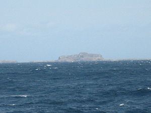
Ilhéu de Cima is an uninhabited island of Cape Verde. It is part of the Ilhéus Secos islet group, located 4 km east of Ilhéu Grande, the other main islet of the group, and 8 km northeast of the island Brava. They are administratively a part of the Brava municipality. Surrounding islets include Ilhéu Luíz Carneiro (or Luis Carneiro), Ilhéu Sapado and Ilhéu do Rei (Portuguese for King's Islet). The island is an integral nature reserve, famous for its seabirds colonies. In the island's south there is a lighthouse located about 80 m above sea level.
Other geographic features include Baixa or Boca de Porto in the west and Baixo Cabeção (Baixo Cabeçon) and Baixo Daniel (Baixo Dánel).
Tourism and fishing are rarely common around the islet.
The island has its only building, its lighthouse used for ships around Brava. Ships headed to and from Mindelo and others such as Southwestern Europe and Brazil cross within the lighthouse from the 1880s and the Great Depression of 1929.
Its average temperature is 23 °C., its highest temperature in March is 26 °C, and the lowest temperature being 22 °C in June. Average yearly rainfall is 280 mm, the wettest is in September with 125 mm and the driest is in April with only a millimeter.