
Population 306 (2011 census) Local time Saturday 9:04 AM | Postcode(s) 2850 Postal code 2850 Federal division Division of Parkes | |
 | ||
Weather 17°C, Wind NE at 5 km/h, 65% Humidity | ||
Ilford is a small town in New South Wales, Australia, in the Mid-Western Regional Council. It is named after the small English town of Ilford (then in Essex, now in east London), where the founders of this town came from. It is situated around 220 km north west of Sydney. It is located on the Castlereagh Highway, which is locally referred to as Sydney Road. The Bathurst-Ilford Road (MR 54) (which comes from Bathurst and skirts past Sofala) joins the Castlereagh Highway on the northern outskirts of town and the Bylong Valley Way to the upper Hunter Region via Kandos, Rylstone and Bylong joins the Castlereagh Highway 2 kilometres (1.2 mi) north of town.
Contents
Map of Ilford NSW 2850, Australia
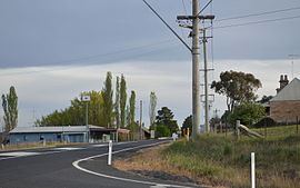
Unremarkable in appearance, Ilford appears no more than a T Junction on the "Sydney Road." The primary school, on the left heading North toward Mudgee, and the information bay, are most of what is visible to travellers, on their way to Mudgee. Take the turnoff, just past the children's school, on the left, to Sofala then onto Bathurst.
Ilford was a settlement of about 100 people in 1875. At the 2011 census, Ilford recorded a population of 306. However, this figure does not reflect just the town itself; it is the total for the census region of 528.5 square kilometres (204.1 sq mi) which includes Ilford and also a considerable area to the South and West, incorporating a number of other settlements including Mount Vincent, Razorback, and Running Stream.
Ilford is one of several rural New South Wales towns to initiate a farmhouse rental program, offering farmhouses for rent for $1 per week to attract new residents to the area.
The Astronomical Society of New South Wales runs a property "Wiruna" just outside Ilford, which is one of the country's premier dark-sky observing sites, used by the society's members and guests. Each year since 1993, the Society has hosted the "South Pacific Star Party" there. This event attracts between 200 and 400 amateur star-gazers from Australia and abroad, effectively doubling the population of the region for the weekend. It is also used as a fund-raising opportunity for the local Scouts who provide hot food.