Area 498.9 km² Local time Saturday 3:42 AM | Population 2,471 (1 Apr 2005) | |
 | ||
Time zone Japan Standard Time (UTC+9) Weather -3°C, Wind NW at 11 km/h, 77% Humidity Region | ||
Ikawa (井川村, Ikawa-mura) was a village located in Abe District, Shizuoka Prefecture, Japan.
Map of Ikawa, Aoi Ward, Shizuoka, Shizuoka Prefecture 428-0504, Japan
On January 1, 1969 Ikawa joined with neighboring Shizuoka city. It is now part of Aoi-ku, Shizuoka.
As of January 1, 1969-final population data before the amalgamation, the town had an estimated population of 2,471 and a density of 4.95 persons per km². The total area was 498.90 km².
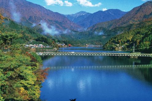
Ikawa, located in the mountainous area between Shizuoka and Yamanashi Prefecture is the location of Ikawa Dam, a major hydroelectric power plant for Shizuoka Prefecture. It is also a popular sightseeing location for local residents. "Ikawa Menpa" which is a lacquered hinoki wooden lunch box is a local speciality.
References
Ikawa, Shizuoka Wikipedia(Text) CC BY-SA
