
Country Japan Population 27,341 (1 Apr 2015) | Area 14.27 km² Local time Saturday 3:33 AM | |
 | ||
Time zone Japan Standard Time (UTC+9) City hall address 3-7-12 Hōryūjinishi, Ikaruga-cho,630-8580 Weather 5°C, Wind W at 6 km/h, 83% Humidity | ||
Ikaruga (斑鳩町, Ikaruga-chō) is a town in Ikoma District, Nara, Japan.
Contents
- Map of Ikaruga Ikoma District Nara Prefecture Japan
- Neighboring municipalities
- Geography
- Elementary schools
- Junior high schools
- High schools
- Temples and shrines
- Kofun
- Rail
- Road
- References
Map of Ikaruga, Ikoma District, Nara Prefecture, Japan
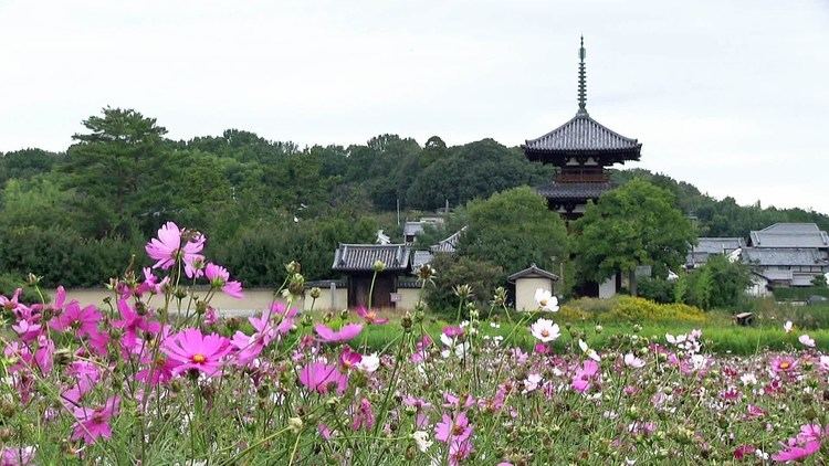
Ikaruga is home to Hōryū-ji and Hokki-ji, ancient Buddhist temples collectively inscribed as UNESCO World Heritage. Other ancient temples include Hōrin-ji, also in the vicinity of Hōryū-ji. The town was named after the Palace of Prince Shōtoku-Taishi, Ikaruga-no-Miya (Imperial Palace of Ikaruga, or Imperial House of Ikaruga), whose grounds were at Hōryū-ji, thus it is also called Ikaruga-dera (temple of Ikaruga).
As of April 1, 2015, the town has an estimated population of 27,341, with 11,308 households. The total area is 14.27 km2 (6 sq mi).
Neighboring municipalities
Geography
Elementary schools
Junior high schools
High schools
Temples and shrines
Kofun
Rail
Road
References
Ikaruga, Nara Wikipedia(Text) CC BY-SA