
Admin. region Oberbayern Municipal assoc. Igling Area 26.37 km² Population 2,407 (31 Dec 2008) Dialling code 08248 | Elevation 593-611 m (−1,412 ft) Local time Friday 4:07 PM Postal code 86859 | |
 | ||
Weather 8°C, Wind NW at 16 km/h, 52% Humidity | ||
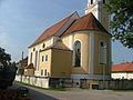
Igling is a municipality in the district of Landsberg in Bavaria in Germany.
Contents
- Map of Igling Germany
- Subdivisions
- Population development
- History
- Politics
- Culture and sights
- Education
- References
Map of Igling, Germany
Subdivisions
The municipality Igling consists of the subdivisions (Ortsteile) Holzhausen, Unterigling and Oberigling.
Population development
In 1970 1,656 were residing in Igling, in 1987 1,767 people lived in Igling, and 2005 2,125 residents lived in Igling.
History
Igling belonged to the barons of Donnersberg. The village was part of the Electorate of Bavaria and formed a "geschlossenes Hofmark" which place of residence Oberigling has been. In the course of administrative reform in Bavaria accrued through the Gemeindeedikt today's municipal.
During the second world war many areas were dispossessed. The castle was confiscated by the SS and happened to be the field office of the Landsberger jail after the war. Until 1945 the Lager II der Außenlagergruppe Landsberg/Kaufering of the concentration camp Dachau existed there. Afterward fugitives were accommodated in the castle.
The train station on the rail route Munich-Memmingen has been closed.
Politics
Mayor of Igling is Christl Weinmüller.
Culture and sights
Education
In 1999 the following institutions existed: