
Max. width 10 kilometres (6.2 mi) Average depth 4 metres (13 ft) Surface elevation 390 m Length 13 km Shore length 164.7 km | Max. length 13 kilometres (8.1 mi) Surface area 68.16 km (26.32 sq mi) Max depth 41 m Area 68.16 km² Width 10 km | |
 | ||
Reference Norwegian Water Resources and Energy Directorate | ||
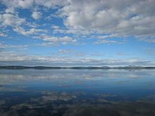
Iešjávri (or Iesjavri) is a large lake on the border of the municipalities of Alta, Kautokeino, and Karasjok in Finnmark county, Norway. The lake lies on the Finnmarksvidda plateau about 50 kilometres (31 mi) northwest of the village of Karasjok, about 30 kilometres (19 mi) northeast of the village of Masi, and about 45 kilometres (28 mi) southeast of the town of Alta.
Map of Ie%C5%A1j%C3%A1vri, Norway
The 68.16-square-kilometre (26.32 sq mi) lake is the largest in the county and has a length of over 13 kilometres (8.1 mi) from north to south. The lake has a maximum depth of 41 metres (135 ft) and an average depth of 4 metres (13 ft), making it a characteristic Baltic Shield lake. The lake flows out into the river Iešjohka, a tributary of the large river Karasjohka.
References
Iešjávri Wikipedia(Text) CC BY-SA