
 | ||
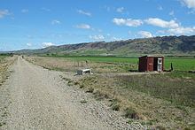
The Ida Valley lies east of the Manuherikia Valley in Central Otago, New Zealand. At an altitude of around 500 m (1,600 ft), the 40 km long flat and wide valley is a relatively dry region with cold winters and hot summers, much like the rest of Central Otago. The majority of agricultural production in the Ida Valley is lamb, including merino, and also stud cattle. The valley is named after the Ida Burn, which joins the Poolburn and breaks through the Raggedy Range via the Poolburn Gorge.
Contents
Map of Ida Valley 9387, New Zealand
The largest settlement in the sparsely populated Ida Valley is Oturehua, a small village at the northern end. Two other smaller settlements, "Poolburn", and "Ida Valley" are rather groups of a few houses and farms than villages, although Poolburn is the location of the local full primary school.
The Ida Valley Omakau Road leads through much of the valley and connects it with Omakau and Idaburn, both on State Highway 85.
Tourism
The valley has a rich gold mining heritage, with remnants of mines and workings on display in and around Oturehua.
The Otago Central Rail Trail leads through much of the Ida Valley from Idaburn through to the Poolburn Gorge, a scenic section of this cycle trail encompassing two viaducts as well as two tunnels. Local operators provide bike hire and coach transport for day trips of varying length between Oturehua and Omakau. Oturehua also provides accommodation options for multi-day bike trips on the rail trail.