
Local time Friday 1:46 PM | Region Kantō Area 64.25 km² Population 11,664 (May 2015) | |
 | ||
Weather 11°C, Wind NW at 18 km/h, 44% Humidity | ||
Ichikai (市貝町, Ichikai-machi) is a town located in Haga District, Tochigi Prefecture, in the northern Kantō region of Japan. As of May 2015, the town had an estimated population of 11,664 and a population density of 182 persons per km². Its total area was 64.25 km².
Contents
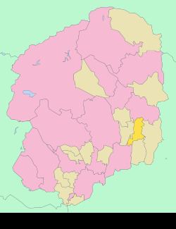
- Map of Ichikai Haga District Tochigi Prefecture Japan
- Geography
- Surrounding municipalities
- History
- Economy
- Education
- Railway
- Highway
- References
Map of Ichikai, Haga District, Tochigi Prefecture, Japan
Geography
Ichikai is located in eastern Tochigi Prefecture.
Surrounding municipalities
History
Ichihane and Kokai villages were created within Haga District on April 1, 1889 with the creation of the municipalities system. The two villages merged to form Ichikai village on May 3, 1954. Ichikai was elevated to town status on January 1, 1972.
Economy
The economy of Ichikai is heavily dependent on agriculture. It is also a bedroom community for nearby Utsunomiya, Mooka and Haga.
Education
Ichikai has three primary schools and one middle school.
Railway
Highway
References
Ichikai, Tochigi Wikipedia(Text) CC BY-SA