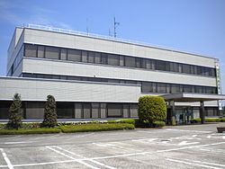
- Flower Chinese pear Population 15,899 (Dec 2016) | Region Kantō Area 70.16 km² Local time Wednesday 1:31 AM | |
 | ||
Weather 3°C, Wind N at 26 km/h, 87% Humidity | ||
Haga (芳賀町, Haga-machi) is a town located in Haga District, Tochigi Prefecture, in the northern Kantō region of Japan. As of May 2015, the town had an estimated population of 15,254 and a population density of 217 persons per km². Its total area was 70.16 km².
Contents
- Map of Haga Haga District Tochigi Prefecture Japan
- Geography
- Surrounding municipalities
- History
- Administration
- Demographics
- Economy
- Education
- Railway
- Highway
- Buses
- Heliports
- Notable people from Haga
- References
Map of Haga, Haga District, Tochigi Prefecture, Japan
Geography
Haga is located in southeastern Tochigi Prefecture. The river Gogyō, a tributary of the river Kokaigawa flows through Haga.
Surrounding municipalities
History
Ubagai, Minatakazeawa and Mizuhashi villages were created within Haga District on 1 April 1889 with the creation of the municipalities system. Ubagai was elevated to town status on 1 November 1928. Ubagai merged with Minatakanezawa and Mizuhashi to form Haga on 31 March 1954.
Administration
Demographics
As of December 2016, the population of Haga is 15,899, of whom 7,978 are male and 7,921 are female. The following table displays the historical populations of Haga:
Economy
Major companies located at Haga-machi industrial complex include:
Education
Haga has three primary schools and one middle school.
Railway
Highway
Buses
JR Bus Kantō: Sakushin Gakuin-mae – Twin Ring Motegi via Utsunomiya Station and Motegi Station, Sakushin Gakuin mae – Saga-Onsen Roman no Yu via Utsunomiya Station.
Heliports
Tochigi Heliport
