
Population 101 Civil parish Ibberton Local time Thursday 11:16 PM | OS grid reference ST788077 Sovereign state United Kingdom | |
 | ||
Weather 7°C, Wind S at 3 km/h, 100% Humidity | ||
Ibberton is a village and civil parish in the county of Dorset in southern England. It is situated in the Blackmore Vale under the scarp face of the Dorset Downs, 5 miles (8.0 km) south of Sturminster Newton and 7 miles (11 km) west of Blandford Forum. The parish covers almost 1,400 acres (570 ha) and extends over the chalk downs that lie to the south. In the 2011 census the parish had a population of 101, a reduction from 134 in 2001.
Map of Ibberton, Blandford Forum, UK
The name Ibberton derives from the Old English Ēadbeorht (a personal name), ing and tūn, and means 'estate associated with the man Ēadbeorht'. In 1086 in the Domesday Book it was recorded as Abristetone. Later variants of the name include Ebrictinton and Edbrichton.
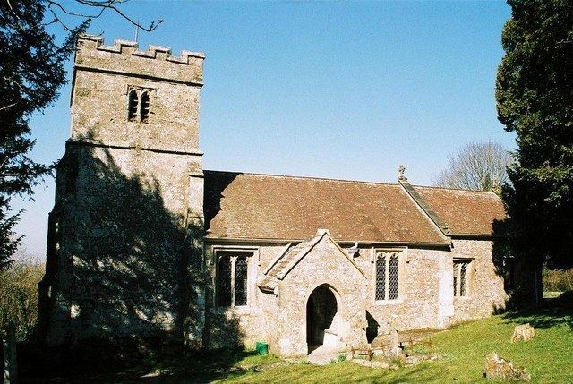
The parish church of St Eustace occupies a site that gives far-reaching views northwards over the Blackmore Vale, and Ibberton Hill to the south provides an even loftier vantage point.
Community facilities within the village include a village hall, which is also used by the neighbouring villages of Belchalwell and Woolland, and a cricket ground.