Harman Patil (Editor)

IRIS (transportation software)

Updated on
Edit
Like
Comment
Share on FacebookTweet on TwitterShare on LinkedInShare on Reddit
Written in
  
Java

Available in
  
English, uses I18N

Operating system
  
Cross-platform

Type
  
ATMS

IRIS (transportation software)

Developer(s)
  
Minnesota Department of Transportation

Initial release
  
May, 2007 (2017-05-09UTC20:07)

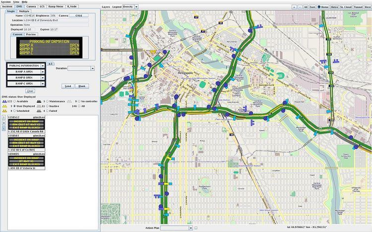
IRIS (Intelligent Roadway Information System) is an open-source Advanced Traffic Management System (ATMS) software project developed by the Minnesota Department of Transportation. It is used by transportation agencies to monitor and manage interstate and highway traffic. IRIS uses the GPL license.

Contents

Functional areas

  • Variable speed limit monitoring and control
  • Active traffic management and lane control
  • Congestion Detection
  • Automated Warning System (AWS)
  • Road Weather Information Systems (RWIS)
  • Dynamic message sign monitoring and control
  • Ramp meter monitoring and control
  • Traffic camera monitoring and control
  • Vehicle Detector Stations (VDS) for monitoring real-time vehicle speed, flow, density
  • Toll tags
  • Incident tracking, monitoring, and storage
  • Data export: real-time traffic, incidents, configuration, etc.
  • Integrated mapping
  • Supported hardware devices

  • DMS
  • NTCIP Class A, B, C
  • Addco, Daktronics
  • Skyline: full sized DMS, VSL, scroll signs
  • Wanco portable DMS
  • DMS XML: a simple XML protocol for interfacing with external DMS systems
  • Road Weather Information System
  • Optical Scientific ORG-815 Optical Rain Gauge
  • SSI
  • Traffic cameras
  • PTZ: Manchester, Pelco D, Vicon, Infinova
  • Switchers: Pelco, Vicon
  • VDS
  • Canoga
  • Wavetronix SmartSensor 105
  • Wavetronix SmartSensor 125
  • EIS RTMS (UDP)
  • EIS G4
  • Caltrans URMS 2070: UDP, TCP, TCP Re-ID
  • Sensys
  • Tag readers
  • Bluetooth: Iteris Velocity
  • Bluetooth: Acyclica
  • Transcore Encompass 6 Multiprotocol Reader
  • Minneapolis / Saint Paul IRIS System

    The IRIS implementation in the Minneapolis – Saint Paul region consists of:

  • DMS: 135
  • VDS: 5452
  • RWIS: 4
  • Cameras: 476
  • Ramp meters: 433
  • LCS: 194 (most can also be used as DMS)
  • Lane marking: 1 (in-road lighting)
  • Static sign with wig-wag beacons: 2
  • Transportation agencies using IRIS

  • Minnesota Department of Transportation
  • California Department of Transportation
  • Wyoming Department of Transportation
  • Wisconsin Department of Transportation
  • References

    IRIS (transportation software) Wikipedia


    Similar Topics