
Postcode area IG Post towns 6 Postcode sectors 35 | Postcode districts 11 Postcodes (live) 6,039 | |
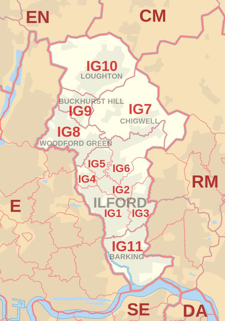 | ||
The IG postcode area, also known as the Ilford postcode area, is a group of 11 postcode districts in England, which are subdivisions of six post towns. These postcode districts cover parts of eastern Greater London and southwest Essex. Inward mail for the IG postcode area is sorted at the Romford Mail Centre, with the E and RM postcode area mail.
Contents
The area served includes much of the London Borough of Redbridge, the western part of the London Borough of Barking and Dagenham and the southwestern part of the Epping Forest district of Essex, while the western part of IG8 covers a small part of the London Borough of Waltham Forest.
The 'IG' is used instead of 'IL', as the latter could be confused with '11' or 'LL'. It is sometimes said that the G stands for the last letter in Barking, which itself is situated in IG11.
Coverage
The approximate coverage of the postcode districts:
London E19
In April 2005, a local businessman Wilson Chowdhry started a campaign to have IG1 postcodes changed to London E19, on the pretext that IG1 is not always recognised as a 'London postcode'. He argued that so doing would help local businesses. A Royal Mail spokesman, however, said campaigners in Ilford had "virtually no hope" of changing their postcode. This had previously been raised by the then Greater London Council politician Serge Lourie in the 1970s and similarly rejected. Ilford had been removed from the London postal district in 1866.
Map
The southern boundary is the River Thames. Part of the western boundary is the North Circular Road and the River Roding.