
Max. depth 180 m (590 ft) Area 4.1 km² | Surface area 4.1 km (1.6 sq mi) Surface elevation 378 m | |
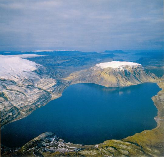 | ||
The lake Hvalvatn is situated some kilometers to the east of Hvalfjörður in the western portion of Iceland. It lies to the east of the volcano Hvalfell. The surface measures 4.1 km2 (1.6 sq mi), and its greatest depth is 180 m (590 ft).
Map of Hvalvatn, Iceland
Not far from Hvalvatn is Glymur, the highest waterfall in the country. Hiking trails lead both to the lake and to the waterfall.
References
Hvalvatn Wikipedia(Text) CC BY-SA