
Founded 1876 | Area 2,318 km² Population 21,819 (2013) Unemployment rate 3.5% (Apr 2015) | |
 | ||
Website www.co.hutchinson.tx.us | ||
Hutchinson County is a county in the U.S. state of Texas. As of the 2010 census, its population was 22,150. Its county seat is Stinnett. The county was created in 1876 but not organized until 1901. It is named for Andrew Hutchinson, an early Texas attorney.
Contents
- Map of Hutchinson County TX USA
- Native Americans
- Early explorations
- Early ranch entrepreneurs
- County established
- Geography
- Major highways
- National protected area
- Demographics
- Cities
- Town
- Census designated place
- Other unincorporated communities
- Ghost towns
- Notable residents
- References
Map of Hutchinson County, TX, USA
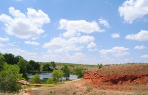
Hutchinson County comprises the Borger, TX Micropolitan Statistical Area, which is also included in the Amarillo-Borger, TX Combined Statistical Area. It is located in the northern portion of the Texas Panhandle. The history of Hutchinson County is accented in downtown Borger in the Hutchinson County Historical Museum, also known as Boomtown Revisited.
Native Americans
Artifacts of the Antelope Creek Indian culture abound along the Canadian valley in Hutchinson County. Archaeologists have found 1,300 acres (5.3 km2) of Alibates flint in the area that was used as a quarry for shaping flint tools. Nomadic Plains Apache also camped in this area as did Comanche, Arapaho, Kiowa, and Cheyenne.
Bent, St. Vrain and Company established a trading post in this area to tap into Indian trading. Known as Fort Adobe, it was blown up by traders three years later due to Indian depredations. The ruins became known as Adobe Walls.
The First Battle of Adobe Walls took place in 1864 when General James H. Carleton sent Col. Christopher (Kit) Carson into the area to avenge for repeated Indian attacks. Carson and several hundred cavalry officers were greatly outnumbered by Kiowa and Comanche and forced to retreat. The Second Battle of Adobe Walls took place in 1874. A group of buffalo hunters attempted a revitalization of Fort Adobe. The Comanches, Cheyenne, Arapaho and Kiowa saw the fort and the decimation of the buffalo herd as a threat to their existence. Comanche medicine man Isa-tai prophesized a victory and immunity to the white man’s bullets in battle. Quanah Parker lead several hundred in a raid on the fort. The buffalo hunters were able to force the Indians into retreat.
Early explorations
In 1541 an expedition led by Francisco Vásquez de Coronado traversed the area on its Great Plains quest for Quivira on the search for the mythical Seven Cities of Gold. Spanish conquistador Juan de Oñate passed through in 1601 on his Kansas expedition. Buffalo hunters and Comanchero from New Mexico hunted and traded in the vicinity until the 1870s. The first Anglo-American expedition to come through the county was led by Stephen H. Long, who mistook the Canadian River for the Red River, in August 1820. Josiah Gregg brought his Santa Fe caravan through in March 1840. During the month of December 1858 Lt. Edward Beale with one hundred men passed through the county constructing a federally funded military road, the first to be constructed in the American Southwest. The road went from Fort Smith, Arkansas, to Los Angeles. It was named the Beale Wagon Road by Secretary of War John B. Floyd.
Early ranch entrepreneurs
In November 1876 Kansan Thomas Sherman Bugbee established the Quarter Circle T Ranch. The Scissors Ranch was begun in 1878 by William E. Anderson at the Abobe Walls site. The ranch was named after the brand, which looked like a pair of scissors. Coloradan Richard E. McNalty moved to Texas and began the Turkey Track Ranch, which he sold to Charles Wood and Jack Snider in 1881. Scotland-born James M. Coburn formed the Hansford Land and Cattle Company. The Quarter Circle T. Ranch and Scissors Ranch were sold to Coburn in 1882. Coburn acquired the Turkey Track Ranch in 1883.
County established
Hutchinson County was established in 1876. The county was not organized until 1901, at which time Plemons became the county seat. For the next four decades ranching dominated the county's economy, while crop cultivation made gradual headway.
The Panhandle oilfield was discovered in the 1920s. On June 1, 1923, the Sanford No. 1 J. C. Whittington well in southwestern Hutchinson County reached a depth of 3,077 feet (938 m) and found flowing oil. Towns sprang up in response. The population mushroomed from 721 in 1920 to 14,848 in 1930 as a result of the oil boom. By 1990 – 526,670,107 barrels (83,733,855.6 m3) of oil had been taken from Hutchinson County lands since 1923.
Stinnett became the county seat after a special election on September 18, 1926.
Geography
According to the U.S. Census Bureau, the county has a total area of 895 square miles (2,320 km2), of which 887 square miles (2,300 km2) is land and 7.5 square miles (19 km2) (0.8%) is water.
Major highways
National protected area
Demographics
As of the census of 2000, there were 23,857 people, 9,283 households, and 6,869 families residing in the county. The population density was 27 people per square mile (10/km²). There were 10,871 housing units at an average density of 12 per square mile (5/km²). The racial makeup of the county was 87.00% White, 2.41% Black or African American, 1.35% Native American, 0.35% Asian, 0.02% Pacific Islander, 6.66% from other races, and 2.21% from two or more races. 14.70% of the population were Hispanic or Latino of any race.
There were 9,283 households out of which 34.80% had children under the age of 18 living with them, 61.40% were married couples living together, 9.10% had a female householder with no husband present, and 26.00% were non-families. 23.90% of all households were made up of individuals and 11.90% had someone living alone who was 65 years of age or older. The average household size was 2.54 and the average family size was 3.00.
In the county, the population was spread out with 27.40% under the age of 18, 8.70% from 18 to 24, 25.50% from 25 to 44, 22.70% from 45 to 64, and 15.60% who were 65 years of age or older. The median age was 38 years. For every 100 females there were 97.00 males. For every 100 females age 18 and over, there were 93.60 males.
The median income for a household in the county was $36,588, and the median income for a family was $42,500. Males had a median income of $40,029 versus $19,952 for females. The per capita income for the county was $17,317. About 8.80% of families and 11.10% of the population were below the poverty line, including 14.70% of those under age 18 and 7.30% of those age 65 or over.