
 | ||
Arc hunua ranges mtb park new zealand gopro
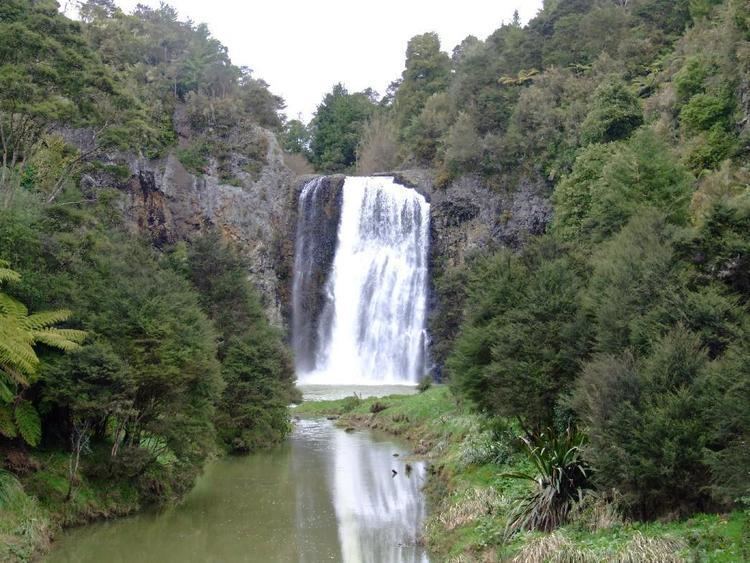
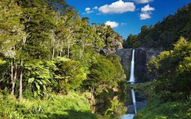
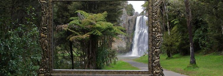
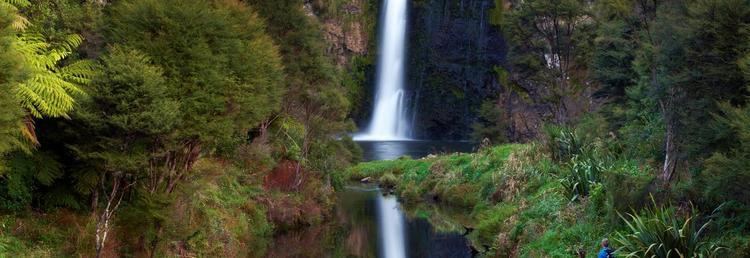
The Hunua Ranges form a block of hilly country to the southeast of Auckland in New Zealand's North Island. They cover some 250 square kilometres (97 sq mi), containing 178 km² of parkland, and rise to 688 metres (2255 ft) at Kohukohunui. Auckland gets much of its water from reservoirs within the Hunua Ranges. The ranges contain many rivers and streams, including the Hunua Falls on the Wairoa River, which is a popular tourist and local spot in the Ranges.
Contents
- Arc hunua ranges mtb park new zealand gopro
- Friends of hunua ranges launch day
- Water ReservoirsEdit
- References
The ranges are located approximately 50 kilometres (30 mi) southeast of Auckland, above the western shore of the Firth of Thames. They are sparsely populated, and mostly lie within the boundaries of the Waharau and Hunua Ranges Regional Parks. The settlement of Hunua lies on the foot of the Hunua Ranges.
Maori made some use of the ranges and early European visitors found areas of clearing that had been used as gardens. Ngāi Tai are tangata whenua. Some Maori archaeological sites are known. The main part of the ranges was subject to confiscation after the New Zealand Wars.
Early European use of the ranges was for timber extraction and for farming but low soil fertility limited success. There has been some mining of Manganese in the past. Gold prospecting for quartz reefs has never found payable reefs.
Friends of hunua ranges launch day
Water ReservoirsEdit
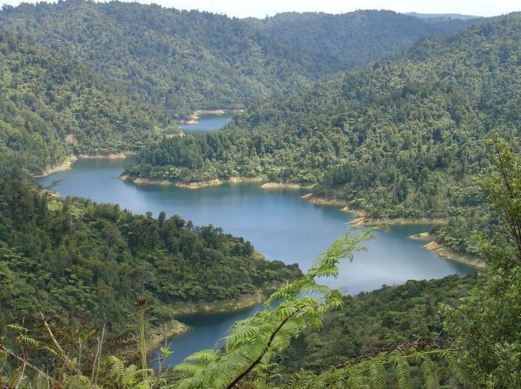
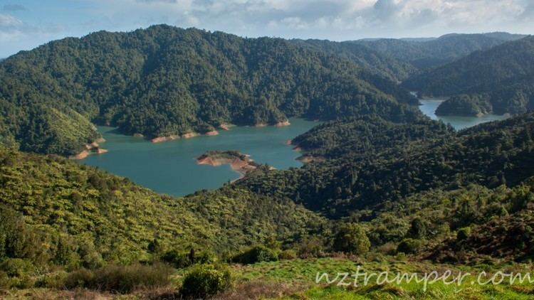
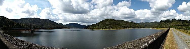
From the 1920s onwards the land was progressively bought by Auckland City Council utilising funds from its water supply operation. Development of the water supplies commenced in the late 1940s, with the first of the four dams, Cossey’s, completed with a capacity of 11.3 million cubic meters. Three further dams: Mangatawhiri, Wairoa and Mangatangi were completed in 1965,1975 and 1977 respectively. Combined, the dams have a capacity of 77.1 million cubic meters, and supply approximately 68% of Auckland’s potable water, through the Ardmore Water Treatment Plant.
The bulk water supply operation and the land passed to the newly formed Auckland Regional Authority in 1964. The Authority completed the water supply development and continued the exotic afforestation on some of the north and western catchment land, started by the City Council, and its Water Department administered the land.
The water operation was corporatised as Watercare Services Ltd in 1992, but the land itself remained with the Auckland Regional Council (as it was by then). Watercare took ownership of the water related assets and took a long term lease from the Auckland Regional Council of the reservoir areas and the operational areas. The exotic forestry land was also leased to another party. The catchment land became regional park land.
In November 2010, the southernmost part of the Hunua Ranges were transferred to Waikato Region. This determines the local government administrative boundaries, but the ownership of the former Auckland Regional Council park land went to the Auckland Council and that of the water assets is unchanged with Watercare Services.