
Country United States County Mecklenburg ZIP codes 28070, 28078 Elevation 252 m Population 50,458 (2013) | Time zone Eastern (EST) (UTC-5) Area code(s) 704, 980 Local time Thursday 8:49 PM | |
 | ||
Weather 6°C, Wind W at 3 km/h, 25% Humidity Neighborhoods Allison Ferry, Hicks Crossroads, Hunters Pointe, Torance | ||
Town of huntersville north carolina virtual tour wilson realty
Huntersville is a town in Mecklenburg County, North Carolina, United States. A part of the Charlotte metropolitan area, the population was 46,773 at the 2010 census, and had increased to 52,704 according to the 2015 census annual estimate, making Huntersville the 17th largest municipality in North Carolina. It is located about 12 miles north of uptown Charlotte. It is thought that the town derives its name from the Rev. Humphrey Hunter, a minister at Steele Creek and Unity Presbyterian Churches and a local Revolutionary War hero. Others debate that it is either named for Robert B. Hunter, a local cotton farmer, or the generous and kind grade-school teacher Elizabeth Hunter and her husband, Travis Hunter, the town's first Crossing Guard.
Contents
- Town of huntersville north carolina virtual tour wilson realty
- Map of Huntersville NC 28078 USA
- Geography and the government
- Demographics
- Transportation
- Media
- Recreation
- NASCAR in Huntersville
- Attractions
- Notable people
- School system
- Charter schools
- Private schools
- Libraries
- References
Map of Huntersville, NC 28078, USA
Geography and the government
Huntersville is located at 35°24′34″N 80°51′49″W (35.409544, -80.863622).
According to the United States Census Bureau, the town has a total non-contiguous area of 31.2 square miles (81 km2), of which, 31.1 square miles (81 km2) of it is land and 0.03% is water.
The town is governed by an elected Mayor and a Board of Commissioners and elections are officially conducted on a non-partisan basis. Elections are held every two years with the Mayor and Commissioners being elected separately. There is no primary election for either Mayor or the Board of Commissioners. Voters are allowed to vote for up to six (6) Commissioner candidates and the six candidates receiving the highest number of votes are elected.
The current Mayor and Town Board after the November 3, 2015 election: Mayor John Aneralla; Commissioners Danny Phillips, Mark Gibbons, Rob Kidwell, Dan Boone, Charles Guignard, and Melinda Bales. Danny Phillips received the highest number of votes with 2,563.
The preceding Mayor and Town Board consisted of Mayor Jill Swain and Commissioners Melinda Bales, Ron Julian, Rob Kidwell, Sarah McAulay, Jeff Neely, and Danny Phillips. Melinda Bales received the highest number of votes in 2013 with 3,037.
Demographics
As of the 2010 census, there were 46,773 people, 9,171 households, and 6,859 families residing in the town. The population density was 801.4 people per square mile (309.4/km²). There were 9,859 housing units at an average density of 316.5 per square mile (122.2/km²). The racial makeup of the town was 88.42% White Americans, 7.47% African American, 0.37% Native American, 1.50% Asian, 0.05% Pacific Islander, 1.06% from other races, and 1.13% from two or more races. Hispanic or Latino of any race were 3.88% of the population.
There were 9,171 households out of which 41.9% had children under the age of 18 living with them, 64.6% were married couples living together, 7.5% had a female householder with no husband present, and 25.2% were non-families. 19.2% of all households were made up of individuals and 3.4% had someone living alone who was 65 years of age or older. The average household size was 2.67 and the average family size was 3.09.
Despite the rapid growth and 9,171 households, and 6,859 families as of 2010, crime has been kept to a minimum. Residents consider the town a safe place to raise a family.
In the town, the population was spread out with 28.3% under the age of 18, 6.2% from 18 to 24, 40.7% from 25 to 44, 18.6% from 45 to 64, and 6.2% who were 65 years of age or older. The median age was 33 years. For every 100 females there were 97.6 males. For every 100 females age 18 and over, there were 96.0 males.
The median income for a household in the town was $71,932, and the median income for a family was $80,821 (these figures had risen to $80,328 and $90,739 respectively as of a 2007.) Males had a median income of $53,553 versus $33,877 for females. The per capita income for the town was $30,256. 3.1% of the population and 1.9% of families were below the poverty line.
Transportation
Huntersville is one of three towns (the others are Cornelius and Davidson) located north of Charlotte, North Carolina, but still within Mecklenburg County. These three towns make up the area known as "North Meck." Express bus transportation and an interstate with HOV lanes that ends five miles south of Huntersville provide access to the downtown business areas of Charlotte, making Huntersville primarily a town of commuters.
Two exits from Interstate 77 serve Huntersville. Exit 23 (Gilead Road) connects the expressway with the original town. Exit 25 (North Carolina Highway 73, but most often referred to as Sam Furr Road) provides access to the Birkdale Village area and shopping, medical, and office complexes that have been built since the exit opened.
Huntersville is served by Charlotte-Mecklenburg Schools, with students from Huntersville attending Hough High School (which opened in the fall of 2010), Hopewell High School and North Mecklenburg High School. Central Piedmont Community College's North Campus (which features training facilities for law enforcement and auto mechanics in addition to the usual academic subjects) is located off Statesville Road, just south of Mount Holly-Huntersville Road.
Media
The town is served by six weekly newspapers, including "The Lake Norman Citizen" and "The Herald Weekly".
Recreation
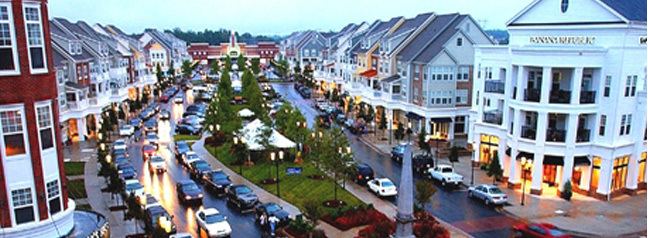
The town also is known recreationally as a lake community because of its proximity to Lake Norman, a large man-made lake created by Duke Power to serve the nuclear power plant, and Mountain Island Lake, a smaller man-made lake that is used as Charlotte's city water source and located along the southwest border of Huntersville. The lakes attract both boaters and water-skiers from several surrounding states. Huntersville is also home to one private golf course, NorthStone Country Club; two Semi-Private courses in Skybrook Golf Club; and Birkdale Golf Course. These two courses are owned and operated by the IRI group and are a part of the 6-course Carolina Trail where package deals are available.
NASCAR in Huntersville
Huntersville is headquarters to the NASCAR race shops of Joe Gibbs Racing, located in the Huntersville Business Park off I-77 exit 23. The shop currently operates four Sprint Cup Series teams: the #11 FedEx Toyota Camry, the #18 M&M's Toyota Camry, the #19 Subway Restaurants Toyota Camry and the #20 Dollar General Toyota Camry.
Attractions
Huntersville is home to the annual Carolina Renaissance Festival, operating Saturdays and Sundays, in October and November.
Notable people
School system
Residents of the Huntersville area attend Charlotte-Mecklenburg Schools. Elementary schools include:
Middle schools include:
High schools include:
Charter schools
Private schools
Libraries
Huntersville and the surrounding area is served by the North County Regional branch of the Public Library of Charlotte and Mecklenburg County. The library is located on Holly Crest Lane, just southeast of exit 25 on I-77, off of Sam Furr Road.