
Population 269 (2001 Census) Civil parish Hungarton Local time Thursday 9:26 PM District Harborough UK parliament constituency Rutland and Melton | OS grid reference SK690073 Sovereign state United Kingdom Dialling code 0116 | |
 | ||
Weather 8°C, Wind W at 19 km/h, 80% Humidity | ||
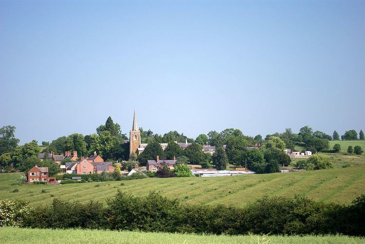
Hungarton (or Hungerton) is a small village in the county of Leicestershire, England. It is about 10 miles (16.1 km) north-east of Leicester and 13 miles (21 km) south-west of Melton Mowbray. The village is mentioned in the 1086 Domesday Book as Hungretone. The population of the civil parish was 269 at the 2001 census, including Ingarsby and increasing to 289 at the 2011 census.
Contents
Map of Hungarton, Leicester, UK
The layout of the village of Hungarton follows that of the model village built between 1764 and 1776 by Shukburgh Ashby, then the owner of nearby Quenby Hall. There are a few cottages that pre-date these houses and many houses have been built since.
The village has a church, a village hall, a small stream and a Millennium Green. It also has a pub called The Black Boy. Stilton cheese was first produced in a dairy in the grounds of Quenby Hall.
The Anglican Church of St John the Baptist is part of a group benefice with Keyham, Billesdon, Goadby and Skeffington. A service is held there twice a month.
The parish now and then
The parish of Hungarton covers over 4000 acres (16 km²) of land. and includes the three estates of Quenby Hall, Baggrave and Ingarsby as well as the village.
A bill to enclose common lands in the village was introduced in 1762.
John Marius Wilson: Imperial Gazetteer of England and Wales (1870–72):
"HUNGERTON, a village, a township, and a parish in Billesdon district, Leicestershire. The village stands between the two branches of the river Wreak, 6 miles SE by E of Syston Junction r. station, and 7 NE by E of Leicester; and has a post office under Leicester. The township includes the village. Real property, £1,565. Pop., 196. Houses, 48. The parish contains also the liberty of Baggrave, and the hamlets of Ingarsby and Quenby. Acres, 2,910. Real property, £5,945. Pop., 302. Houses, 64. The property is divided among a few. Baggrave Hall is the seat of E. A. Burnaby, Esq. Quenby Hall has, for upwards of seven centuries, belonged to the Ashbys. Ingarsby Hall, an old moated building, is now a farm house. The living is a vicarage, united with the vicarage of Twyford and the p. curacy of Thorpe-Satchville, in the diocese of Peterborough. Value, £320. Patron, the Rev. E. Q. Ashby. The church is ancient; was restored in 1851; and consists of nave, chancel, and S aisle, with porch and lofty spire. There are a Wesleyan chapel and some charities."Samuel Lewis, editor: A Topographical Dictionary of England (1848):
"HUNGERTON (St. John the Baptist), a parish, in the union of Billesdon, chiefly in the hundred of Gartree, S. division, but partly in that of East Goscote, N. division, of the county of Leicester, 7 miles (E. by N.) from Leicester; comprising the liberty of Baggrave, and the hamlets of Ingarsby and Quenby; and containing 267 inhabitants. The living is a discharged vicarage, with that of Twyford and the chapelry of Thorp-Satchville united in 1732, valued in the king's books at £9. 8. 1½., and in the alternate patronage of the families of Peacocke and Ashby; net income, £220."Notable people
In birth order