
 | ||
Address Camino Catemito 1910-1914, San Bernardo, Región Metropolitana, Chile Similar Pucara del Cerro La Muralla, Cerro El Plomo, Chilean National Museum, Cerro Blanco, Santiago Metropolitan Park | ||
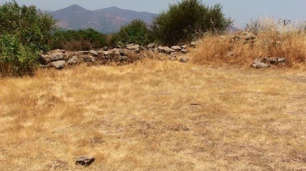
Huaca de Chena, also known as the Chena Pukara, is an Inca site on Chena Mountain, in the basin of San Bernardo, commune of Calera de Tango, Maipo Province, Chile. Tala Canta Ilabe was the last Inca who celebrated Inti Raymi in its Ushnu.
Contents
- pucar de chena que hacer en santiago lugar 9
- History
- Architecture
- Form of a feline as Cuzcos City
- The astronomic observatory of Huaca de Chena
- Calendar
- Skills of observation
- Determination of geographical North South Axis
- Winter solstice
- The Huaca de Chena
- Pre Hispanic cemetery
- Sacred place today
- References
The word Chena means puma in estrous cycle in the Quechuan language.
pucar de chena que hacer en santiago lugar 9
History
Constructed during the domination of the Qullasuyu, the fortress of Chena Mountain is located at Cucará Point, up to where one accedes for the Catemito Road.
In 1976, archeologist Rubén Stehberg published the report "Chena's Fortress and its relation with the inca occupation of central Chile". The topographic raising that the engineer Hans Niemeyer realised at it, emphasised the needings of a researcher in archaeology.
Architecture
This fortress possesses a set of nine enclosures placed in the summit of the hill and of two defensive walls of surrounding. The first approximation to a new interpretation, was published in 1991. This one points that the perimeter of the walls of the pucara, it suggests the form of an animal, possibly a feline. And the defensive walls would not be such but three areas of the Inca cosmovision .
Form of a feline as Cuzco's City
This form similar to an animal (unique in Chile), is similar to the figure of a puma that was represented in the plant of the cardinal city of Inca Empire, Cusco.
Sarmiento de Gamboa indicated that the city was conceived for you builders with the form of a puma. Fernando and Edgardo Elorrieta, describe great quantity of incaic buildings located in the sacred valley, which forms of animals resemble, some of them related to the dark constellations that they saw in the night sky. Also they describe associations of these buildings with the astronomy.
The back part of this feline, presents openings of doors, corridors and separations between walls, which allow the step of the first beam of the Sun in solstice and equinox. The step of the first beam of the Sun in the winter solstice on (June 21) across four doors crosses a sense. During the dawn of the summer solstice (December 21) a months later, the last beam of the Sun crosses the inverse way.
The astronomic observatory of Huaca de Chena
In 1996, published a new article in a magazine of Engineering.
It approached a new offer of interpretation, according to which the pucara might be a ritual site and an astronomic observatory not a fortress. The abundant specialized literature indicates that the Inca astronomers realised observations of high precision and were constructing observatories along the territory that they were occupying. These observatories were necessary for elaboration of calendars with agricultural, religious, civil purposes, etc. Boccas, penetrates into this line of analysis.
Calendar
Due to the big distances that normally existed between villages and the need to cross them afoot, makes presume that every accession of relative importance, was relying on an observatory that was allowing the inhabitants, your own and one handled calendar. The Inca accession that the Spanish found on having come to the valley of Santiago surely was not the exception. The date in which the Sun passes for nadir (antizenith) also was known, and a temporary axis was forming with the step for zenith. In the Inca city Wanuku Pampa Aveni discovered two important buildings which orientation is glaringly different from the rest of the city: they align with the axis( zenith - anticenit, which names later " standard time of Cuzco ", since he suggests that the Incas, on not having been able to apply the same temporary criteria in all your empire (s passed the tropics, the Sun never passes for the zenith - Chena's case-), had to support a calendar coherence between remote places of your empire and the capital. In Chena, we have not seen this type of alignment towards "Cuzco's time zone".
Skills of observation
June 21 is the holiday of Inti Raymi, new year Inca. If the Inca was stopping in the beginning of the most short red line, he was observing the first beam of the Sun went out across a groove between two walls. The Sun was rising after Ushnu or altar. During the celebration of the Inti Raymi of 2006 in the pucara, the young archeologist and mountaneer Ricardo Moyano observed the exit of the Sun and recognized hills the depression in where the Sun goes out, as the so-called Portezuelo del Inca. Up to this moment this name did not have explanation. From this observation, in Stehberg's opinion, it might be a question of the first line of ceque found in Santiago. In Cuzco, the ceques were consisting of imaginary lines that Coricancha was departing from and they were going towards every huaca, shaping a whole of 328 huacas. They were fulfilling functions of political, social and religious order. The Coricancha was the principal temple of the Inca culture.
To the dawn of the equinox, the Sun crosses the door of the enclosure orient and then crosses the corridor. To the late afternoon it realizes the inverse way. The diagonal of the corridor of access indicates the line North - South.
By means of this simple method, and using mud and stones as materials of construction, the astronomers Incas were achieving observations of great precision.
Determination of geographical North - South Axis
For example, to determine the astronomic or geographical north, is enough to observe the point of exit and the point of putting of the star Vega (Lira's Alpha), Urcu Chillay or macho calls for the Incas, about the winter solstice. Then to look for the average point, this represents the north. Probably this simple method allowed to the former astronomers to determine the axis North - South. The following scheme, product of more than one decade of observation in situ of astronomic events, shows the system of astronomic observation to simple sight, probably used by the Incas astronomers to design the pucara and then to realize your observations of the apparent movement of the stars.
Winter solstice
The surrise of the winter solstice occurs in a "key" point from Chena's ushnu: the intersection of the most nearby horizon (Chena's cord) and of the most distant (mountain chain of the Coast). In addition, in this precise direction one finds the summit of the highest hill (1.166 msnm) that reaches to the south of the Cuesta Zapata. This detail might not be a coincidence, but a topographic important requirement, due to the association known about the high hills with the worship to the water in several cultures
The Huaca de Chena
A huaca (Quechuan Wak'a) is a sacred place, a space of ritual use. The previous descriptions seem to indicate that Chena's Pucará was and it is a huaca.
" This Andean sacralización of his geography has precedents of long byline in the Andes and there must not be thought that it is only incaica, though, Tawantinsuyu He adapts it of the way that more is convenient to his political interests. In addition, one must not believe that this geographical perception is applied only to the nuclear Andean area. On the contrary, to where they were the state civil servants Tawantinsuyu or his influence was coming, there spreads this particular way of perceiving and organizing the physical world "
The reasons that they support this place as ceremonial and not as military compound:
Pre-Hispanic cemetery
33°36′39.94″S 70°45′15.81″W
At basement of the monunt they found also two cemeteries, presumably diaguita, separated one of other one for approximately 600 metres (2,000 ft). The diaguitas, for the especial preoccupation showed in your burials, think that they have a life post-death in which the flame has a basic role. The dual ceramics appear towards the belief of the existence of two worlds in which them shamanthat they are the link. With the arrival of the Incas there was brought the tradition of doing altars in the highest hills of the valley
Sacred place today
In contrast with this physical abandon, in the last decade, diverse groups and persons are re-discovering the pucara. QuechuanAymará distinguishes the community from Santiago, which realizes negotiations with the authorities in order to recover the Huaca de Chena as a ritual space for the new generations of descendants from the original Andean etnias. The communities estimate importantly that the descendants from the Andean villages could recover this sacred place (nowadays in virtual abandon), to possess a ritual own space inside the city. This would allow them to establish a physical and spiritual link with your cultural inheritance.