
Car plates LHR | Area 1,269 km² | |
 | ||
Gminas Total 8 (incl. 1 urban)HrubieszówGmina DołhobyczówGmina HorodłoGmina HrubieszówGmina MirczeGmina TrzeszczanyGmina UchanieGmina Werbkowice | ||
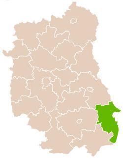
Hrubieszów County (Polish: powiat hrubieszowski) is a unit of territorial administration and local government (powiat) in Lublin Voivodeship, eastern Poland, on the border with Ukraine. It was established on January 1, 1999, as a result of the Polish local government reforms passed in 1998. Its administrative seat and only town is Hrubieszów, which lies 104 kilometres (65 mi) south-east of the regional capital Lublin.
Contents
Map of Hrubiesz%C3%B3w County, Poland
The county covers an area of 1,269.45 square kilometres (490.1 sq mi). As of 2006, its total population is 68,822, out of which the population of Hrubieszów is 18,617 and the rural population is 50,205.
Neighbouring counties
Hrubieszów County is bordered by Tomaszów Lubelski County to the south-west, Zamość County to the west and Chełm County to the north-west. It also borders Ukraine to the east.
Administrative division
The county is subdivided into eight gminas (one urban and seven rural). These are listed in the following table, in descending order of population.