
Surface area 1.14 km (0.44 sq mi) Surface elevation 56 m Length 5 km | Max. length 5 km (3.1 mi) Max. depth 20 m (66 ft) Area 114 ha | |
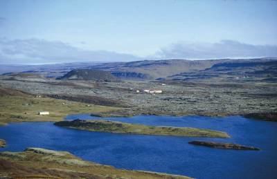 | ||
Hreðavatn is a lake in the west of Iceland. It is situated near Route 1 (the Ring Road) between Borgarnes and the pass of Holtavörtuheiði. Nearby is the university faculty of Bifröst and the Grábrók craters as well as the mountain Baula.
Map of Hre%C3%B0avatn, Iceland
The surface of the lake is 1.14 km², it lies 56 m above sea level, its length is about 5 km and its greatest depth 20 m. It is embedded in a scenic landscape of heath and small forest plantations.
References
Hreðavatn Wikipedia(Text) CC BY-SA