
Elevation 610 m | Area 32.66 km² | |
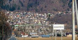 | ||
Hranovnica is a village and municipality in Poprad District in the Prešov Region of northern Slovakia.
Contents
Map of 059 16 Hranovnica, Slovakia
History
In historical records the village was first mentioned in 1294.
Geography
The municipality lies at an altitude of 613 metres and covers an area of 32.662 km². It has a population of about 2860 people.
Infrastructure and economy
Hranovnica is one of the startpoints to Slovenský raj mountain area. The village has a good tourist infrastructure. Cultural sightseeings are Roman Catholic and evangelical churches, both built or reconstructed in classical style.
References
Hranovnica Wikipedia(Text) CC BY-SA