
Type Reservoir Basin countries United States Max depth 24 m Mean depth 11 m | Primary outflows Beaver Creek Surface elevation 1,380 m Area 8.053 km² Water volume 76.6 million m³ | |
 | ||
Primary inflows Catchment area 79 square miles (205 km) | ||
Howard Prairie Lake is a reservoir located 4,526 feet (1,380 m) above sea level in Jackson County, Oregon, United States. It is 18 miles (29 km) east of Ashland. The lake is formed by the 100-foot (30 m) tall Howard Prairie Dam, which impounds Beaver Creek, in the Klamath River watershed.
Contents
Map of Howard Prairie Lake, Oregon 97520, USA
History
The reservoir was created in 1958 when the 100-foot (30 m) tall earthfill dam was completed by the Talent Division of the Rogue River Basin Project. A canal diverting water from nearby Little Butte Creek, (in the Rogue River watershed), to the lake was also completed.
Statistics
Howard Prairie Lake has an average surface area of 1,990 acres (8 km2), and an average volume of 62,100 acre feet (76,599,200 m3). It has a maximum depth of 80 feet (24 m), and an average depth of 35 feet (11 m). The lake has a 79-square-mile (205 km2) drainage basin.
Flora and fauna
Howard Prairie Lake is known for its large number of rainbow trout, largemouth bass, and smallmouth bass. Ducks and geese inhabit the surrounding regions. The lake is surrounded by pine and fir forests in the Cascade Mountains.
Recreation
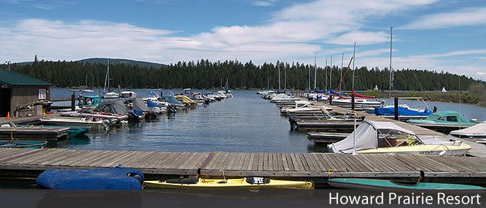
Boating, water skiing, fishing, and camping at the three public campgrounds are popular activities at the lake. Hiking and biking are also popular on trails around the lake. The Howard Prairie Lake Resort is located on the northern shore of the lake and features a large marina, boat ramp, restaurant, campground, and convenience store.