
Founded 1882 Website www.co.howard.tx.us Population 36,147 (2013) | Named for Volney E. Howard Area 2,341 km² | |
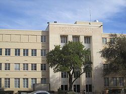 | ||
Colleges and Universities Howard College, Southwest Collegiate Institute for the Deaf Rivers Beals Creek, Calf Creek, Powell Creek | ||
Howard County is a county located in the U.S. state of Texas. As of the 2010 census, its population was 35,012. Its county seat is Big Spring. The county was created in 1876 and organized in 1882. It is named for Volney E. Howard, a U.S. Congressman from Texas.
Contents
- Map of Howard County TX USA
- Geography
- Major highways
- Adjacent counties
- Demographics
- Media
- Cities
- Towns
- Census designated place
- Unincorporated communities
- Ghost Town
- References
Map of Howard County, TX, USA
Howard County is included in the Big Spring, TX Micropolitan Statistical Area.
Geography
According to the U.S. Census Bureau, the county has a total area of 904 square miles (2,340 km2), of which 901 square miles (2,330 km2) is land and 3.4 square miles (8.8 km2) (0.4%) is water.
Howard County is located at the boundary between the Llano Estacado to the north and the Edwards Plateau to the south. Beals Creek, a tributary of the Colorado River flows through the center of Big Spring and divides these two major physiographic regions.
Major highways
Adjacent counties
Demographics
As of the census of 2000, there were 33,627 people, 11,389 households, and 7,949 families residing in the county. The population density was 37 people per square mile (14/km²). There were 13,589 housing units at an average density of 15 per square mile (6/km²). The racial makeup of the county was 80.14% White, 4.13% Black or African American, 0.59% Native American, 0.59% Asian, 0.01% Pacific Islander, 12.43% from other races, and 2.10% from two or more races. 37.46% of the population were Hispanic or Latino of any race.
There were 11,389 households out of which 32.80% had children under the age of 18 living with them, 53.30% were married couples living together, 12.20% had a female householder with no husband present, and 30.20% were non-families. 26.80% of all households were made up of individuals and 13.20% had someone living alone who was 65 years of age or older. The average household size was 2.53 and the average family size was 3.07.
In the county, the population was spread out with 24.20% under the age of 18, 9.00% from 18 to 24, 30.90% from 25 to 44, 21.30% from 45 to 64, and 14.60% who were 65 years of age or older. The median age was 36 years. For every 100 females there were 118.00 males. For every 100 females age 18 and over, there were 122.50 males.
The median income for a household in the county was $30,805, and the median income for a family was $37,262. Males had a median income of $28,971 versus $21,390 for females. The per capita income for the county was $15,027. About 14.50% of families and 18.60% of the population were below the poverty line, including 24.70% of those under age 18 and 15.50% of those age 65 or over.
Media
The county is served by a daily newspaper, local stations KBST (AM), KBST-FM, KBTS (FM), KBYG (AM), nearby stations KBXJ (FM), KPET (AM) and KWDC (FM), and the various Midland and Odessa radio and TV stations.
Cities
Towns
Census-designated place
Unincorporated communities
Ghost Town
Ross City