
Population 1,364 (2011 census) Postal code 4659 | Postcode(s) 4659 Local time Thursday 4:29 AM | |
 | ||
Weather 24°C, Wind S at 6 km/h, 90% Humidity | ||
Howard is a small town and rural locality in the Fraser Coast Region, Queensland, Australia. It is located 284 kilometres (176 mi) north of Brisbane and 37 kilometres (23 mi) west of Hervey Bay. In the 2011 census, Howard had a population of 1,364 people.
Contents
- Map of Howard QLD 4659 Australia
- Geography
- History
- Heritage listings
- Amenities
- Education
- Notable residents
- References
Map of Howard QLD 4659, Australia
Geography
The Bruce Highway passes through the locality in an east-west direction skirting the edge of the town. Queensland's main north-south railway line passes in a NW-SE direction through the town centre. The main streets of Howard are Steley and William.
History
The first Burrum Post Office opened on 22 July 1878 and was renamed Howard in 1883.
Burrum Provisional School opened on 18 February 1879. On 3 October 1884, it was renamed Howard State School.
Howard was the seat of the Howard Division (1900-1903) and its successor Shire of Howard (1903-1917).
The Howard War Memorial was unveiled by Colin Rankin on 17 December 1921. Unusually for an Australian war memorial, the statue was made in Italy and depicts a soldier in Italian uniform.
Heritage listings
Howard has a number of heritage-listed sites, including:
Amenities
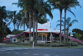
Steley Street contains the skatepark, railway station, children's playground, community centre, kindergarten, respite centre, located on the southern end. Over the railway line is the Howard Sawmill, producers of kiln dried Queensland hardwood. The post office, drapery and patchwork store, hairdresser, grocery and hardware store are on the northern end. The C.W.A hall is also located in Steley Street. The historic wooden foot bridge over the railway line in Steley Street near the C.W.A Hall was demolished in 2016 as it became too expensive to maintain. It was a popular spot for photographing trains traveling north or south. William Street consists of a milk bar, butcher, bakery, pharmacy, hotel, bottle shop, newsagency, IGA supermarket, chip shop, doctor and several real estate agents. Howard also has a golf course on the outer part of the main part of town. (The Bowls Club is located at Torbanlea)
Education
Howard State School is a government primary (P-7) school at 108 William Street (25.322864°S 152.557444°E / -25.322864; 152.557444 (Howard State School)). In 2012. the school had an enrolment of 177 students with 12 teachers (11.3 full-time equivalent). There is no secondary school in Howard; the nearest are in Childers to the north-west, Hervey Bay to the east and Maryborough to the south.