Trisha Shetty (Editor)

Hosín

Updated on
Edit
Like
Comment
Share on FacebookTweet on TwitterShare on LinkedInShare on Reddit
Country
  
Czech Republic

District
  
České Budějovice

Area
  
30.97 km²

Region
  
South Bohemian

Postal code
  
373 41

Elevation
  
486 m

Hosín httpsuploadwikimediaorgwikipediacommonsthu

Hosín is a village and municipality (obec) in the České Budějovice District in the South Bohemian Region of the Czech Republic.

Contents

Map of 373 41 Hos%C3%ADn, Czechia

The municipality covers an area of 30.97 km2 (11.96 sq mi), and has a population of 751 (as at 31 December 2007).

Hosín lies approximately 7 km (4 mi) north of České Budějovice and 117 km (73 mi) south of Prague.
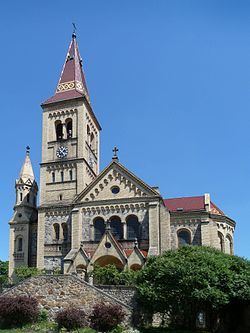
Places of interest

  • Hosín is associated with the silhouette of Saints Peter and Paul Church seen from Českých Budějovic from 1899 to 1900, part of which is the original Romanesque church from the 12th to 13th centuries with unique Gothic wall paintings from around 1340
  • Baroque rectory from the 18th century
  • Stone wayside shrine from 1636 along the road towards Hluboká nad Vltavou, with the coat-of-arms of the former estate owner, Baltasar Marradas
  • Former Orty china-clay mine
  • Memorial to those killed in World War I
  • Wayside cross in the northeast part of the village
  • Houses built in the "rustic Baroque" style: houses no. 8, 42, and 48
  • Notable people

    Notable people that were born or lived in Hosín include:

  • Fran Lakmayer (1863–1946), beekeeper
  • References

    Hosín Wikipedia