
 | ||
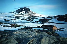
Horseshoe Island is an island 12 km (6.5 nmi) long and 6 km (3 nmi) wide occupying most of the entrance to Square Bay, along the west coast of Graham Land, Antarctica. It was discovered and named by the British Graham Land Expedition under John Rymill who mapped the area by land and from the air in 1936–37. Its name is indicative of the crescentic alignment of the 600 to 900 m (2,000 to 3,000 ft) peaks which give a comparable shape to the island.
Contents
Map of Horseshoe Island, Antarctica
Historic site
Lying at the north-western end of the island is Base Y, also known as Horseshoe Base, an inactive but relatively unaltered and completely equipped British research station of the late 1950s. It includes ‘Blaiklock’, a nearby refuge hut. The site has been designated a Historic Site or Monument (HSM 63), following a proposal by the United Kingdom to the Antarctic Treaty Consultative Meeting.