
- elevation 16 ft (5 m) Phone +1 508-636-8816 | Area 3.298 km² | |
 | ||
Hours Closing soon · 8AM–7PMTuesday8AM–7PMWednesday8AM–7PMThursday8AM–7PMFriday8AM–7PMSaturday8AM–7PMSunday8AM–7PMMonday8AM–7PM Management Department of Conservation and Recreation Similar Demarest Lloyd State Park, Scusset Beach State Res, Salisbury Beach State Res, Freetown‑Fall River State Forest, Otter River State Forest | ||
Westport horseneck beach memorial day 2011
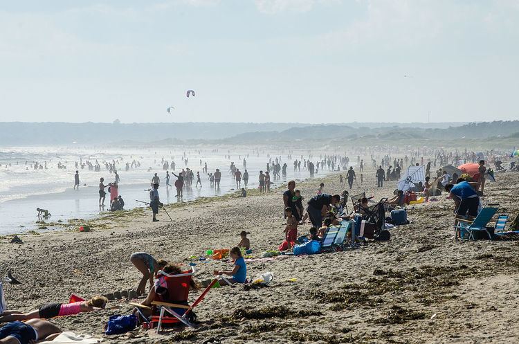
Horseneck Beach State Reservation is a state-owned, public recreation area comprising more than 800 acres (320 ha) on the Atlantic Ocean in the southern portion of the town of Westport, Massachusetts, United States. It is managed by the Massachusetts Department of Conservation and Recreation and is one of the state’s "most popular facilities ... welcom[ing] hundreds of thousands of visitors per year."
Contents
Horseneck beach state reservation april 7 2012
Description
The reservation occupies a peninsula that juts out from Westport's mainland with Rhode Island Sound to the southwest and Buzzards Bay to the southeast. The reservation features 2 miles (3.2 km) of barrier beach, marshland, and a protected estuary habitat. Most of the marshland is concentrated at the northern portion of the peninsula bordering Horseneck Channel and The Let.
The barrier island known as Gooseberry Neck (or Gooseberry Island) is connected by a causeway to the main Horseneck Peninsula and is the southernmost extension of Horseneck Beach State Reservation. It partially divides Rhode Island Sound from Buzzards Bay. Horseneck Beach was acquired by the state in 1956, with Goose Neck being added to the state's recreational holdings in 1957.
The Westport Historical Society notes that the name for the beach is likely taken "from the Algonquin word hassanegk, meaning 'cellar dwelling' or 'a house made of stone.'"
Activities and amenities
The state reservation offers fishing, windsurfing, motorized and non-motorized boating with boat ramp, trails for biking and walking, showers, hunting, and bird watching.
Accessibility
The state reservation is accessible from the Bascule Bridge via Route 88, an offshoot of Interstate 195. Route 88 is the main (and direct) route of the two land routes to Horseneck. Route 88 ends on Horseneck, where John Reed Road, the main road serving the reservation, begins. John Reed Road ends at East Beach Road on the eastern portion of the peninsula. The other land route to Horseneck is East Beach Road via Horseneck Road, on the peninsula's connector, near the Westport/Dartmouth town boundary. The beach is accessible from the several large, designated parking lots via toll gates.