
- summer (DST) CEST (UTC+2) Area 39.85 km² | Elevation 280 m Local time Tuesday 9:40 PM | |
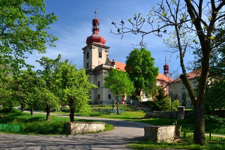 | ||
Weather 7°C, Wind W at 21 km/h, 79% Humidity Points of interest Schloss Jezeří, Jezerka, Bývalá vodárna Jezeří | ||
Horní Jiřetín ( [ˈɦorɲiː jɪr̝ɛciːn]; German: Obergeorgenthal) is a Czech town with 2 183 inhabitants in Most District, in the Ústí nad Labem Region in the foothills of the Ore Mountains on the border with Germany.
Contents
- Map of HornC3AD JiC599etC3ADn Czechia
- Geography
- History
- Notable people
- Municipal parts
- Twin towns Sister cities
- References
Map of Horn%C3%AD Ji%C5%99et%C3%ADn, Czechia
Geography
Horní Jiřetín is located approximately 8 km away from Most, 10 km from Litvínov, 40 km from Ústí nad Labem and 90 km from the Czech capital of Prague.
History
The first documented reference to this municipality is from 1263 when the village Jorenthal is mentioned as being on the road to Saxony. At the time, the village was mainly governed by the Duchcov-based Lobkowicz family. In the 16th century, iron ore was discovered nearby at Červená Jáma. At the end of the 17th century, the village was hit by the bubonic plague and at the end of the 18th, it suffered from a steep financial decline due to war.
After World War II the local German population was expelled.
In 2015, the nearby ČSA surface mining operation requested breaking the mining limits imposed on them. This would lead to the demolition of various towns in the region, including Horní Jiřetín.
Notable people
Municipal parts
Twin towns — Sister cities
Horní Jiřetín is twinned with: