
Country Canada Established 1786 Population 798 (2011) | County Albert Time zone AST (UTC-4) Province New Brunswick | |
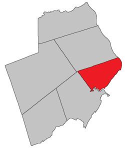 | ||
Hopewell is a Canadian parish in Albert County, New Brunswick.
Contents
- Map of Hopewell NB Canada
- Delineation
- History
- Communities
- Bodies of water Islands
- Access Routes
- References
Map of Hopewell, NB, Canada
Delineation
Hopewell Parish is defined in the Territorial Division Act as being bounded:
North by Hillsborough Parish; southeast by Chignecto Bay; and southwest by a line commencing at the mouth of Shepody River; thence up the centre of the said river to the mouth of Crooked Creek; thence up the centre of the said creek to the old bridge over the same on the old main road; and thence north twenty degrees west to intersect the south line of Hillsborough Parish or its westerly prolongation.History
Albert County: established as a Nova Scotia township in 1765 and became part of the province of New Brunswick in 1786: possibly named for Hopewell, Pennsylvania, home of some of the first settlers to the area: may have also been named for the ship (Hopewell) that brought a group of settlers from Ireland in 1761: Hopewell Parish included Harvey Parish until 1838.
Communities
Parish population total does not include incorporated municipalities (in bold).
Bodies of water & Islands
This is a list of rivers, lakes, streams, creeks, marshes and Islands that are at least partially in this parish
Access Routes
Highways and numbered routes that run through the parish, including external routes that start or finish at the parish limits: