
OS grid reference SJ432681 Dialling code 01244 | Sovereign state United Kingdom | |
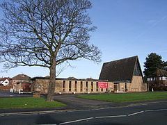 | ||
Hoole Village is a civil parish situated near to Chester, in the unitary authority of Cheshire West and Chester and the ceremonial county of Cheshire, England. In 2004 its population was 230.
Contents
Map of Hoole Village, UK
The parish contains the southern end of the M53 motorway where it becomes the A55 road. At this point it is crossed by the A56 road. Also in the village is Hoole Hall, which is now a hotel.
History
In September 1955 a prehistoric arrowhead and a worked flake were found in a garden in the parish. The arrowhead was dated to the period between the Early Bronze Age and the Early Iron Age (2350 BC to 701 BC). In 1995 aerial photography showed evidence of a Roman practice fort near to Hoole Hall. It is believed that the Roman road from Chester to Wilderspool (now part of Warrington) passed through the parish.
Landmarks and places of interest
Hoole Hall was built as a large house around 1720. The hall itself, its attached conservatory built in the mid 19th century, and the ha-ha wall and railings of the west terrace of the house are Grade II listed buildings. The hall is now used as a hotel. Also listed Grade II is a restored pinfold in Oak Lane.