
Population 940 (1 Jan 2004) Local time Tuesday 1:15 PM | Time zone CET (UTC+1) | |
 | ||
Weather 14°C, Wind W at 24 km/h, 68% Humidity | ||
Tt clasic demo race hooghalen met jaap timmer 24 09 2016
Hooghalen is a town in the Dutch province of Drenthe. It is a part of the municipality of Midden-Drenthe, and lies about 9 km south of Assen.
Contents
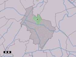
Map of Hooghalen, Netherlands
It is located near the World War II deportation camp Westerbork. There is a museum and several memorials to those transported.
In 2001, the town of Hooghalen had 688 inhabitants. The built-up area of the town was 0.25 km², and contained 271 residences. The statistical area "Hooghalen", which can also include the surrounding countryside, has a population of around 1340.
There is 1 primary school in Hooghalen named "OBS De Bosvlinder" which is located at the Bosweg 1, 9414 BD Hooghalen.
References
Hooghalen Wikipedia(Text) CC BY-SA