
 | ||
Similar High Island Reservoir, Tung Ping Chau, Sharp Island, Taining Taining World Ge, Yuntai Mountain | ||
Dji phantom 3 over po pin chau
Hong Kong UNESCO Global Geopark (Chinese: 香港聯合國教科文組織世界地質公園), formerly Hong Kong National Geopark (香港國家地質公園), was inaugurated on November 3, 2009. It covers an area of 50 km2 across parts of the Eastern and Northeastern New Territories. It includes eight sites (and combinations of sites). On September 18, 2011, UNESCO listed the Geopark as part of its Global Geoparks Network.
Contents
- Dji phantom 3 over po pin chau
- High Island
- Ung Kong Group
- Ninepin Group
- Sharp Island
- Double Haven
- North and south coasts of Tolo Channel
- Port Island Bluff Head
- Tung Ping Chau
- References
The Hong Kong Global Geopark consists of two geological regions: the widely distributed hexagonal rock columns in Sai Kung, which are of international geological significance, and the northeast New Territories region, which comprises sedimentary rocks formed in different geologic periods, showcasing the complete geological history of Hong Kong.
The Geopark is made up of eight Geo-Areas distributed across the Sai Kung Volcanic Rock Region and Northeast New Territories Sedimentary Rock Region.
High Island
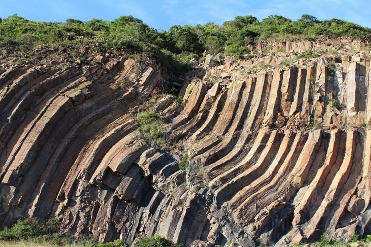
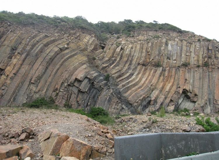
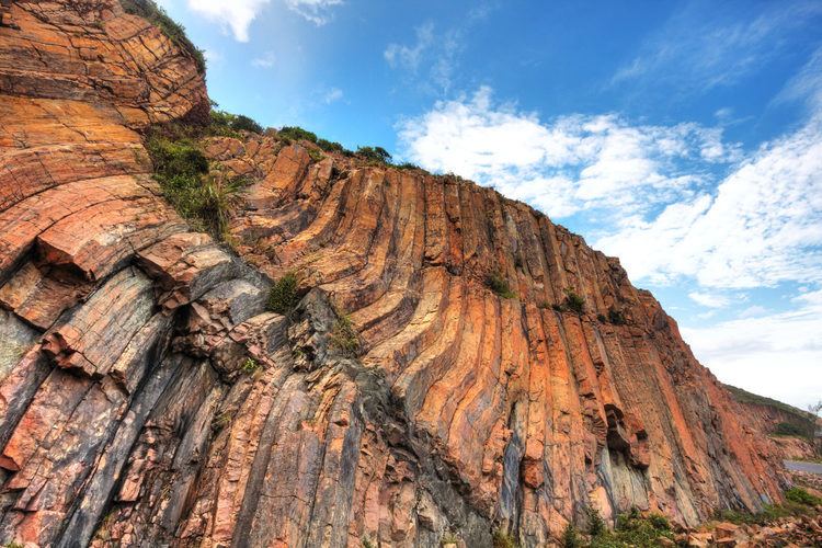
High Island (Chinese: 糧船灣) is the home of the spectacular hexagonal columnar-jointed volcanic rocks. Most of the columns are sub-vertical, straight-sided and parallel. It covers a large area around Sai Kung, includes High Island Reservoir and Tai Long Wan, Sai Kung.
Ung Kong Group
Ung Kong island Group (Chinese: 甕缸群島) is located in southeastern Hong Kong, immediately to the south of the High Island peninsula and to the northwest of the Ninepin group of islands. It consists of Wang Chau (Chinese: 橫洲), Basalt Island (Chinese: 火石洲) and Bluff Island(Chinese: 沙塘口山). Columnar-jointed rocks underlie these islands, giving their cliff coastline a distinctive appearance, and leading to the development of many sea caves and sea arches.
Ninepin Group
Ninepin Group (Chinese: 果洲群島) is located on the eastern side of Hong Kong, forms a series of offshore islands. Numerous inclined columnar jointed volcanic rocks create fascinating cliffs and coastal scenery around the Ninepin Group.
Sharp Island
Sharp Island (Chinese: 橋咀洲) is located in the Inner Port Shelter, to the southeast of the Sai Kung Town, from where it can easily be reached by small boat. The island is underlain by older volcanic-related sedimentary rocks. There is a tombolo reaching to a small island nearby at low tide.
Double Haven
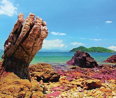
Double Haven or Yan Chau Tong (Chinese: 印洲塘) is a harbour hugged by Double Island, Crescent Island and Crooked Island with north-eastern New Territories. It contains many deep red coloured rocks because of iron oxide.
North and south coasts of Tolo Channel
The Geo-Area includes the north and south shores of Tolo Channel, the oldest rocks in Hong Kong, formed about 400 million years ago during the Devonian Period. Ma Shi Chau(Chinese: 馬屎洲) presents the sedimentary rocks formed about 280 million years ago. Lai Chi Chong(Chinese: 荔枝莊) showcases various volcanic rocks and sedimentary rocks formed about 146 million years ago.
Port Island — Bluff Head
At Bluff Head (Chinese: 黃竹角咀) the oldest rock in Hong Kong is found. They are primarily sandstone, pebbly sandstone and conglomerate. The best-known landmark on Bluff Head is the "Devil's Fist" (Chinese: 鬼手岩). Weathering and erosion occurred along the sandstone bedding forms the shape of the “Ghost fingers”. Port Island (Chinese: 赤洲), as the Chinese name Chek Chau implies, Port Island is a place of red earth. The ground on the entire island is rust-coloured conglomerate and siltstone.
Tung Ping Chau
Tung Ping Chau (Chinese: 東平洲) sits in Mirs Bay of the northeastern Hong Kong. It is the easternmost outlying island of Hong Kong. Tung Ping Chau is a popular holiday destination for locals. Its fascinating attractions, such as wave erosion landscape, the shale that resembles a sponge cake structure and the unusually flat lay of the island itself, have drawn thousands of visitors to the island.