
River mouth 112 ft (34 m) | ||
 | ||
Progression Stony Brook (Millstone River), Millstone River, Raritan River, Atlantic Ocean | ||
Honey branch
Honey Branch is a tributary of the Stony Brook in Mercer County, New Jersey in the United States.
Contents
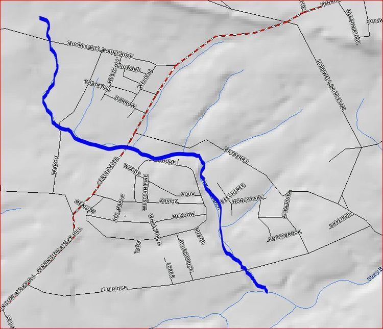
Map of Honey Branch, Hopewell Township, NJ, USA
Course
The Honey Branch starts at 40°22′15″N 74°46′6″W. It flows southeast, crossing Moores Mill Mt. Rose Road. It then turns east and flows across Pennington-Rocky Hill Road. It picks up several tributaries and drains into the Stony Brook Fourteen Basin. After the basin, it crosses Elm Ridge Road and drains into the Stony Brook at 40°20′17″N 74°44′29″W, near Rosedale Park.
Sister tributaries
References
Honey Branch Wikipedia(Text) CC BY-SA