
Admin. region Tübingen Elevation 579 m (1,900 ft) Area 8.14 km² Local time Monday 10:25 PM Dialling code 07340 | District Alb-Donau-Kreis Time zone CET/CEST (UTC+1/+2) Population 271 (31 Dec 2008) Postal code 89183 | |
 | ||
Weather 5°C, Wind W at 10 km/h, 62% Humidity | ||
Holzkirch is a small municipality in the Alb-Donau-Kreis in Baden-Württemberg, Germany. The community belongs to the administration unit Langenau.
Contents
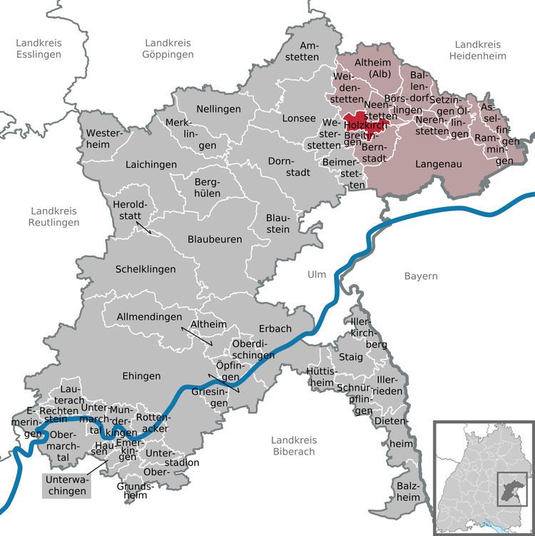
Map of Holzkirch, Germany
Geography
Holzkirch is located on the southern edge of the Swabian Jura north of the Lone valley and north of Ulm.
Neighboring communities
The municipality borders to Weidenstetten, on the east to Neenstetten, in the southeast to Bernstadt, on the south to Breitingen and on the west to Westerstetten.
History
Holzkirch was first documented in 1362 and came 1385 into the possession of the imperial city of Ulm. As Ulm 1803 lost its status, the place came from Ulm to Bavaria. The border between Bavaria and Württemberg in 1810 finally laid down in a contract and Holzkirch became part of Württemberg.
Things
St. Barbara's Church
Buildings
The late Romanesque Barbara Church tower from around 1150 offered around the village for the population protection in troubled times. The very massive cemetery wall was probably for defense.
see also Castle Holzkirch