
 | ||
Holmes run trail info
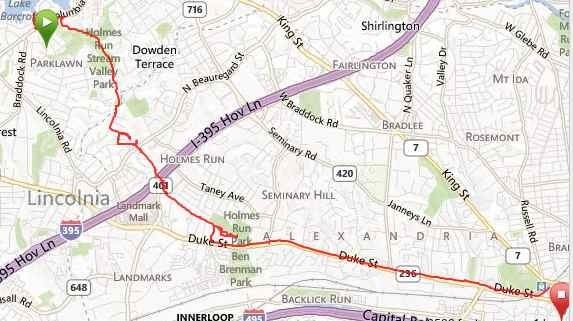
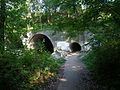
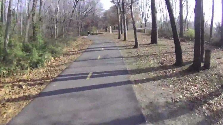
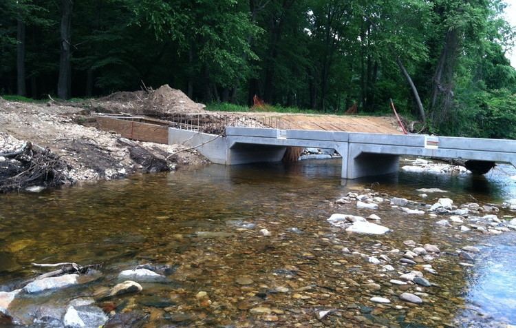
The Holmes Run Trail is a partially paved trail that travels through parks northwest along Holmes Run from Cameron Run in Alexandria, Virginia to Annandale Road (Virginia State Route 649) in Fairfax County, Virginia. The trail travels near the sides of the stream with multiple bridges, some of which are only about a foot higher than the water. The trail consists of two sections that are separated by Lake Barcroft near Columbia Pike (Virginia State Route 244) in Fairfax County.
Contents
The southernmost portion of the trail is 3 miles (4.8 km) in length and travels northwest in Alexandria from Eisenhower Avenue at Cameron Run, next to Cameron Run Regional Park, to the Alexandria/Fairfax County boundary near the end of North Chambliss Street. The portion of the trail that travels northwest in Fairfax County between that boundary and Columbia Pike is 1.25 miles (2.0 km) in length. A bridge over the Run in Alexandria that is located a short distance southeast of the boundary and Fairfax County's Glen Hills Park connects these two portions of the trail, which together comprise the trail's entire 4.25-mile-long (6.8 km) southern section.
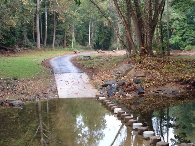
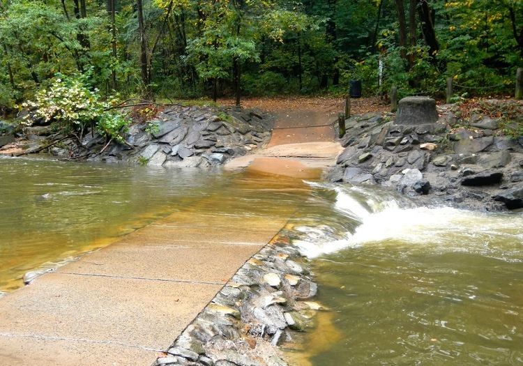
Crossing a stream on holmes run trail
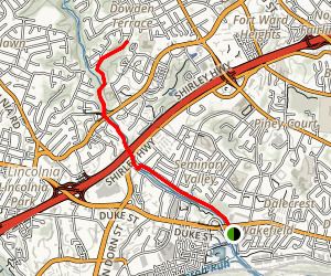
Trail route
The paved 4.25-mile-long (6.8 km) southern section of the Holmes Run Trail begins near Cameron Run Regional Park and the Great Waves Waterpark in southwestern Alexandria. The trail connects near its beginning to the west end of the Eisenhower Avenue Trail, which travels east between Eisenhower Avenue and the north side of Cameron Run to the Hoffman Town Center and the Eisenhower Avenue station on Washington Metro's Blue Line.
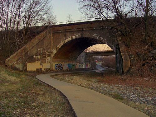
An underpass beneath Eisenhower Avenue connects the Eisenhower Avenue and Holmes Run Trails. The Holmes Run Trail begins by traveling northwest from Eisenhower Avenue along the northeast side of Cameron Run, passing under the Blue Line and three railroad bridges that are separated by sections of Cameron Run Regional Park. The trail then enters the easternmost portion of Ben Brenman Park, where it passes the origin of Cameron Run at the confluence of Holmes Run and Backlick Run.
The trail then travels northwest on the east side of Holmes Run within Ben Brenman Park, where it connects to a paved trail that crosses the Run. That trail travels west near the north side of Backlick Run through Ben Brenman Park and Cameron Station Linear Park to reach Armistead Boothe Park, which is adjacent to the Samuel W. Tucker Elementary School.
After leaving its intersection with the Backlick Run trail, the Holmes Run Trail continues to travel northwest in Alexandria on the east side of the Run and passes under Duke Street. The trail then travels through Holmes Run Park, passing the Charles Beatley Bridge, which crosses the Run to connect the trail with North Pickett Street and Holmes Run Parkway.
The trail continues northwest through Brookvalley Park, where it crosses the Run to the stream's west side. The trail then travels next to the Run under North Van Dorn Street and the Henry G. Shirley Memorial Highway (Interstate 395). The trail then crosses North Beauregard Street and returns to the east side of the Run.
The trail then continues northwest through several wooded sections on the east side of the Run in Dora Kelley Nature Park until it reaches North Chambliss Street, where a bridge carries the trail over the Run to its west side. Shortly thereafter, the trail enters Fairfax County and travels through Glen Hills Park on the Run's west side.
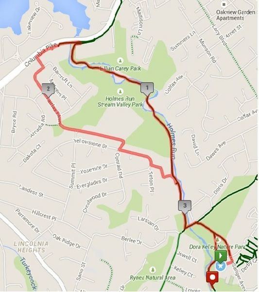
After leaving Glen Hills Park, the southern section of the trail continues northwest on the west side of the Run, passing to the east of the Parklawn Pool. The trail then crosses the Run five times in Holmes Run Stream Valley Park and Lillian Carey Park before it reaches its end on the east side of the Run. The trail section meets at its terminus a trail that travels along the southeast side of Columbia Pike.
Separated by Lake Barcroft from the longer southern section of the trail, the trail's 1.3-mile-long (2.1 km) northern section begins at the southeast side of a cul-de-sac at the north end of Sprucedale Drive, west of Sleepy Hollow Road (Virginia State Route 613) and south of Holmes Run. The trail initially travels east and then turns to travel north, crossing Holmes Run on a bridge to reach the Run's north side. The trail then travels northwest on the north side of the Run through Holmes Run Stream Valley Park. The trail terminates at the south end of Hockett Street, which travels north and connects the trail to the nearby Annandale Road (Virginia State Route 649). While portions of the northern section are paved, that section has a stone dust surface along most of its length.
Flooding
Users of the trail need to know the weather conditions before entering the trail. Holmes Run is part of the Cameron Run/Holmes Run Watershed, and is used to help channel flood waters toward Cameron Run and the Potomac River. Because the trail travels near the level of the water, during and after rainstorms various parts may be submerged, especially on the section of trail that goes underneath Interstate 395.