
Country United States County Suffolk FIPS code 36-35056 Elevation 36 m Zip code 11741 Area code Area codes 631 and 934 | State New York Time zone Eastern (EST) (UTC-5) GNIS feature ID 0952975 Area 18.6 km² Population 27,195 (2010) | |
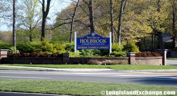 | ||
Holbrook is a hamlet and census-designated place (CDP) in Suffolk County, New York, United States. The population was 27,195 at the 2010 census. The community borders on the east side of Long Island MacArthur Airport.
Contents
- Map of Holbrook NY USA
- History
- Geography
- Demographics of the CDP
- Government
- Roads
- Airport
- Buses
- Train
- Fire and ambulance
- Police department
- Hospital
- Education
- References
Map of Holbrook, NY, USA
History
Holbrook is believed to have gotten its name from a stream which was called in various tellings as either "Old Brook" or "Hollow Brook."
The area was part of the 51,000 acre Islip Grange estate acquired in 1697 by William Nicoll (son Matthias Nicoll who was the 6th mayor of New York City). It was largely a rural area until Alexander McCotter acquired 5,000 acres in the area in 1848 (after the Long Island Rail Road reached it in 1844) and plotted the community. The oldest still standing building from this period is St. John’s Lutheran Church which was built in 1863. In 1875 the Nevins and Griswold cigar factory operated at the original LIRR station.
In 1931 the population was 321. Population increased from 2,500 in 1965 to 15,000 in 1975 to after the Long Island Expressway reached the community in 1969. It also was the center of growth as Long Island McArthur Airport developed along the community's western border.
Geography
Holbrook is located at 40°47′59″N 73°4′32″W (40.799650, -73.075617).
According to the United States Census Bureau, the CDP has a total area of 7.2 square miles (18.6 km2), all land.
Demographics of the CDP
As of the census of 2000, there were 27,512 people, 9,019 households, and 7,350 families residing in the CDP. The population density was 4,032.5 per square mile (1,557.5/km²). There were 9,157 housing units at an average density of 1,342.2/sq mi (518.4/km²). The racial makeup of the CDP was 89.1% White, 1.32% African American, 0.08% Native American, 2.87% Asian, 0.04% Pacific Islander, 0.69% from other races, and 1.05% from two or more races. Hispanic or Latino of any race were 5.9% of the population.
There were 9,019 households out of which 39.1% had children under the age of 18 living with them, 68.8% were married couples living together, 9.5% had a female householder with no husband present, and 18.5% were non-families. 14.3% of all households were made up of individuals and 3.9% had someone living alone who was 65 years of age or older. The average household size was 3.04 and the average family size was 3.38.
In the CDP, the population was spread out with 25.7% under the age of 18, 8.0% from 18 to 24, 32.5% from 25 to 44, 26.2% from 45 to 64, and 7.5% who were 65 years of age or older. The median age was 35 years. For every 100 females there were 94.6 males. For every 100 females age 18 and over, there were 91.8 males.
The median income for a household in the CDP was $72,801, and the median income for a family was $76,349 (these figures had risen to $96,530 and $101,336 respectively as of a 2007 estimate). Males had a median income of $50,040 versus $33,651 for females. The per capita income for the CDP was $26,863. About 2.5% of families and 3.3% of the population were below the poverty line, including 3.6% of those under age 18 and 3.8% of those age 65 or over.
Government
Holbrook is located mainly within the Town of Islip while the section between Portion Road and the Long Island Rail Road tracks is in the Town of Brookhaven. All of Holbrook is within the Sachem School District, which is independent of town borders.
Roads
Roads that pass through Holbrook include:
Airport
Buses
Bus service in Holbrook is provided by Suffolk County Transit.
Train
Holbrook is accessible on the Ronkonkoma Branch of the Long Island Rail Road. The Holbrook station closed in 1962, so the nearest access to the line is at the Ronkonkoma station or Medford station.
Fire and ambulance
Fire and ambulance service is provided by the Holbrook Volunteer Fire Department, operating out of three stations. The Fire Department protects most of Holbrook, and parts of Holtsville, Bayport and Ronkonkoma. Headquarters (Lighting Engine Company, Jupiter Truck Company and Fire-Medic Company) is located at 390 Terry Boulevard. Station #1 (Sun-Vet Engine Company) is located at 1700 Church Street. Station #2 (Eagle Engine Company) is located at 355 Patchogue-Holbrook Road. The Fire District maintains a 24/7/365 paid dispatch and paramedic first responder service. Fire and Rescue services north of the Long Island Railroad Tracks are provided by the Ronkonkoma Fire Department.
Police department
Police services are provided by the Suffolk County Police Department. The 5th Precinct serves the area south of the Long Island Rail Road, and the 6th Precinct serves north of the Long Island Rail Road.
Hospital
The closest hospital to Holbrook is Stony Brook University Hospital, about 7 miles (11 km) north of Holbrook.
Education
Holbrook is within the Sachem School District.
The schools located in Holbrook are three of the twelve elementary schools: Grundy Elementary, Nokomis Elementary, and Merrimac Elementary, and one of the four middle schools: Seneca Middle School.
Holbrook residents attend either Sachem High School North or Sachem High School East, depending on which section of Holbrook they live in. Residents living in the north and west parts of the hamlet go to Sachem High School North in Lake Ronkonkoma, while those living in the south and east parts of the hamlet go to Sachem High School East in Farmingville.
Sachem Public Library is located in Holbrook. A recent poll has ranked their library staff as the second most efficient in New York state behind Yonkers Public Library.