
Country Norway District Hallingdal Area rank 36 in Norway Area 1,858 km² Local time Monday 10:22 AM | County Buskerud Administrative centre Hol Demonym(s) Holing Population 4,556 (2004) Official language form Norwegian Language | |
 | ||
Weather -2°C, Wind SW at 13 km/h, 73% Humidity Points of interest Hallingskarvet National Park, Hol Bygdemuseum, Dagali Museum, Prestholtseter, Hivjufossen | ||
Hol is a municipality in Buskerud county, Norway.
Contents
- Map of Hol Norway
- Administrative history
- Name
- Villages in Hol
- Geography
- Lakes
- Coat of arms
- Hol Old Church
- Notable residents
- Attractions
- Sister cities
- References
Map of Hol, Norway
Administrative history
The area of Hol was separated from the municipality of Ål in 1877 to become a separate municipality. In 1937 a part of neighboring Uvdal with 220 inhabitants was moved to Hol municipality. The area of Dagali was transferred from Uvdal to Hol in 1944. In 1962 Uvdal was reunited with Nore to form the new municipality of Nore og Uvdal.
Name
The municipality (originally the parish) is named after the old Hol farm (Old Norse: Hóll), since the first church was built here. The name is identical with the word hóll, which means "round (and isolated) hill".
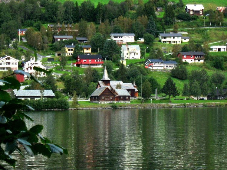
Villages in Hol
Geography
Hol is bordered to the north by Lærdal, to the north and east by Ål, to the south by Nore og Uvdal, and to the west by Eidfjord, Ulvik and Aurland. Hol is a mountainous area, where over 90% of the area is at an altitude exceeding 900 meters above sea level. The Hallingskarvet mountain range is the highest point in the municipality, at 1933 meters above sea level. The Usta or Usteåne River flows northeast from Lake Ustevatn traveling down the Ustedalen valley. The Hallingdalselva River is formed by the confluence of the Usta River and the Holselva River from Lake Strandavatnet.
Lakes
Coat-of-arms
The coat-of-arms of Hol is from modern times; the arms were granted on 5 July 1991. They show three silver anvils on a blue background and were designed by Trond Andersson. The three anvils are stacked one above the other, with the top one being largest and the bottom one smallest. The anvil was chosen to symbolize the former smithies in the municipality, which were famous for the production of axes, blades, and knives. Iron mining was already practiced in the area in the Viking Age.
(See also coat-of-arms of Trøgstad)
Hol Old Church
Hol Old Church (Hol gamle kirke) is presumed to date from the 13th century, but the exact dating is unknown. The church is the oldest parish in Hol and is first mentioned in a letter from 1328 as a small stave church with covered side porches (svalganger). The church has been expanded several times, in the 16th century, in 1697 and in 1798-99. It was rebuilt in 1888 and 1938. It is believed that the floor of the church was made using columns from the old stave church. The pulpit and baptismal font are from the Renaissance period (1697) and the altarpiece from 1703. The pulpit is placed above the altar.
Notable residents
Attractions
Sister cities
The following cities are twinned with Hol: