
Major cities Melbourne | ||
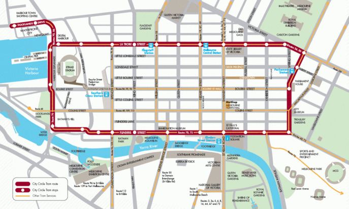 | ||
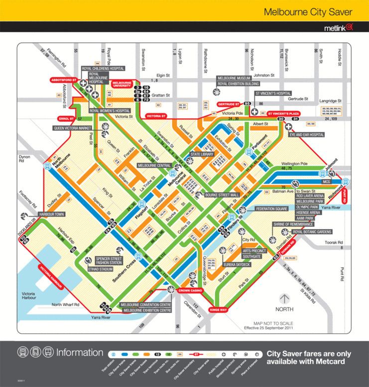
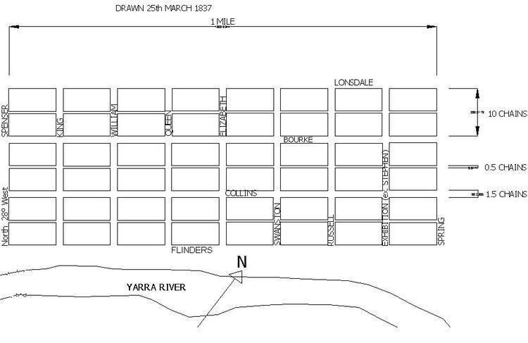
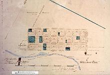
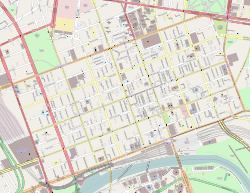
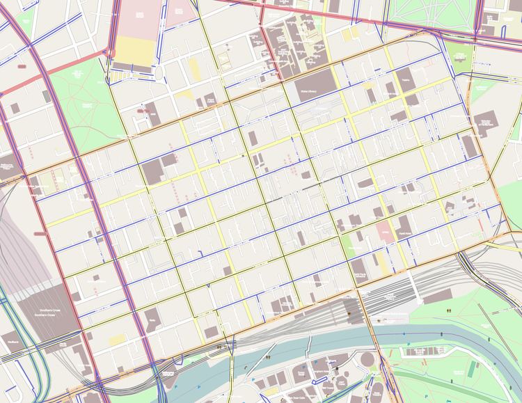
The Hoddle Grid is the layout of the streets in the centre of the central business district of Melbourne. Named after its designer, Robert Hoddle, the grid was laid out in 1837, and later extended. It covers the area from Flinders Street to Queen Victoria Market, and from Spencer Street to Spring Street.
Contents
History
While the survey plan has proved, in time, to be far-sighted for public utility, serving Melbourne to this day, at the time Hoddle's instructions from Governor Gipps were more prosaic.
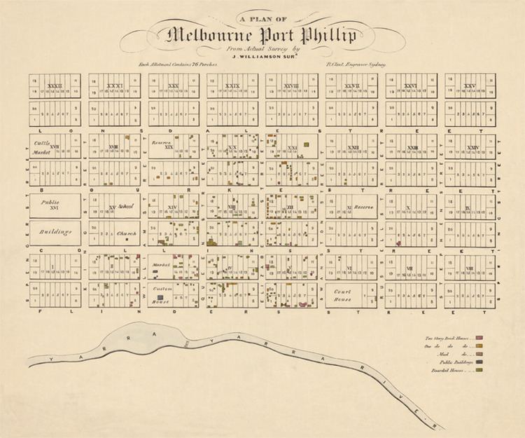
Land allotments for sale at public auction were to be produced as quickly as possible to deliver to the market. Gipps also insisted that all towns laid out during his term of office should have no public squares included within their boundaries, being convinced that they only encouraged democracy.
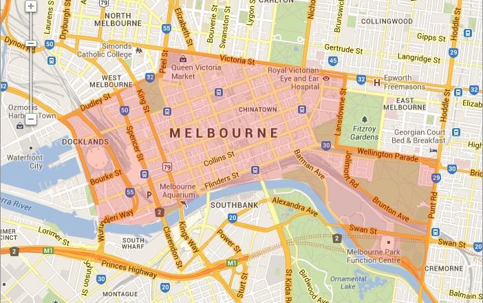
The grid was defined largely by the geography of the area. It was planned to span a gently sloping valley between small hills (knolls) (Batman's Hill, Flagstaff Hill and Eastern Hill) and roughly parallel to the course of the Yarra River. Elizabeth Street, Melbourne in the centre of the grid was built over a gully and has therefore been prone to flooding.
The wide main streets were also to accommodate the large number of bullock carts that would travel through the centre of town preventing them from holding up horse drawn traffic when making right turns.
In the 1860s, surveys extended the district, incorporating the region of similarly laid out streets bounded by Victoria Street, Dudley Street and the Queen Victoria Market.
Specifications
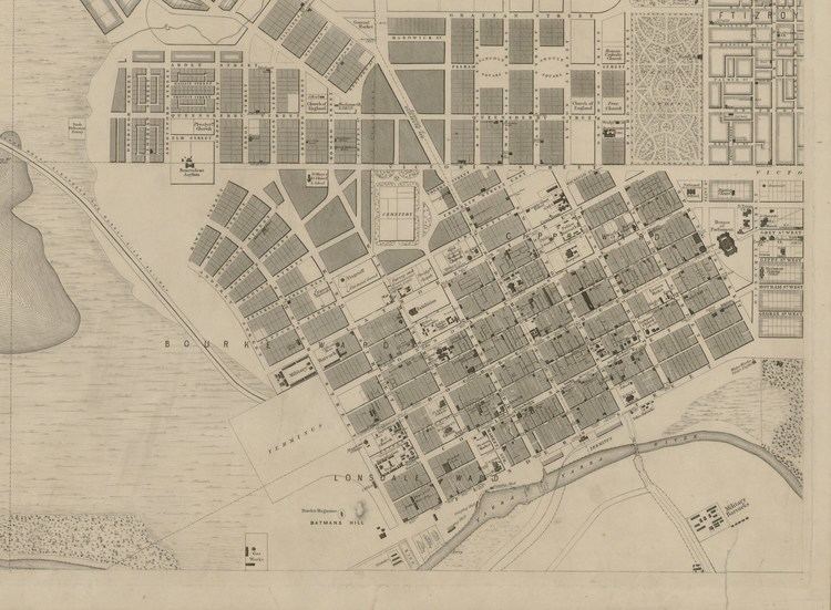
All major streets are one and half chains (99 ft or 30 m) in width, while all blocks are exactly 10 chains square (1 acre, 201 m × 201 m). It is one mile (1.6 km) long by half a mile wide (0.80 km). The grid's longest axis is oriented 70 degrees clockwise from true north, to align better with the course of the Yarra River. The majority of Melbourne is oriented at 8 degrees clockwise from true north - noting that magnetic north was 8° 3' E in 1900, increasing to 11° 42' E in 2009.
East-west streets
Parallel to the Yarra River:
1 One-way westbound, except two-way between Market and Spencer Streets
2 One-way westbound, except two-way between King and Spencer Streets
3 One-way westbound
4 One-way eastbound
North-south streets
Perpendicular to the Yarra River:
1 Runs only between Flinders and Collins Streets, and is the single major deviation from the Grid.
Hoddle Mile Grid
Robert Hoddle also established a separate grid at one mile spacing for sixty miles or so around Melbourne. This cadastral survey determined the orientation of most roads and older subdivisions in the suburbs. The origin of the grid is now marked by a tall blue and yellow pole near where John Batman’s house was on Batman's Hill. The adopted direction for North was to the flagstaff at Flagstaff Gardens which was close to magnetic north in 1837.