
Source Rocky Mountains | Length 88 km | |
 | ||
Progression North-east then north-west Basin size 600 square miles (1,600 km) | ||
Fishing hoback river wy part 3
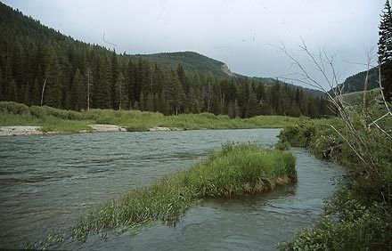
The Hoback River, also called the Fall River, is an approximately 55-mile (89 km)-long tributary of the Snake River in the U.S. state of Wyoming. It rises in the northern Wyoming Range of Wyoming and flows northeast through the Bridger-Teton National Forest, before turning northwest to join the Snake just downstream of Jackson Hole, near the head of the Snake River Canyon and near the town of Hoback. The largest tributary of the Hoback River is its South Fork, which joins it near the town of Bondurant, where the river spreads onto a large marshy flat in a braided floodplain once known as Jackson's Little Hole., but now referred to as the "Hoback Basin". However, most of the river flows through narrow valleys and in its lower course, steep mountain canyons. The entire length of the Hoback is free flowing and unobstructed by dams. About 30 miles (48 km) downstream from the confluence with the Hoback River, the Snake River crosses into the state of Idaho and is impounded by Palisades Dam.
Contents
Map of Hoback River, Wyoming, USA
The river is named after John Hoback, an explorer who traveled with the Astor Expedition from the Snake River, using the Hoback River as a passage to the Green River, a tributary of the Colorado River.